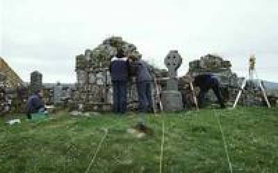
This module will teach modern surveying techniques using Total Stations and DGPS techniques.

The module will take place during the first Reading Week, with follow-up sessions to process your survey data at the Institute. During the module you will learn how to undertake a topographic survey using total stations and GPS, how to download the data into appropriate software, and then how to move the data into a GIS package for further analysis and presentation.
Duration: Reading Week in Term One, plus follow-up sessions at the Institute. Please contact Mark Roberts for further details.
Module Aims
The course seeks to provide students with an understanding of the principal surveying techniques employed by field archaeologists and provide training in undertaking a detailed survey of archaeological remains using a Total Station and dGPS; together with writing and interpreting the resultant survey in a broader archaeological context. The module will teach modern surveying techniques using Total Stations and dGPS techniques. The module will take place during the first Reading Week*, with follow-up sessions to process your survey data at the Institute. During the module you will learn how to undertake a topographic survey using total stations and dGPS, how to download the data into appropriate software, and then how to move the data into a GIS package for further analysis and presentation.
Objectives
This course is designed to give students:
1. An overview of the issues involved in archaeological surveying.
2. Practical understanding and experience in topographical surveying.
3. The opportunity to develop teamwork skills along with the ability to prioritise and structure tasks within a set time period.
4. The ability to download data from the total stations and undertake preliminary analysis.
5. The ability to undertake the production of maps and images of the topographic survey.
6. Experience of combining other archaeological information with the survey to produce a written report and discussion of the site.
7. The basic knowledge from which to critically assess the applicability of individual methods to specific survey situations, and assess survey data presented by others.
8. A sharpened awareness of the processes involved in presenting the results of an archaeological survey, through the completion of a written report.
Teaching Methods
The greater part of the course will be taught during reading week including a field element. The first day to be taught at the Institute will be spent introducing the course, undertaking an initial review of the area to be surveyed and discussing the equipment to be used. The majority of the following four days will be spent in the field undertaking a detailed survey. The site is likely to be in Hertfordshire and within daily commuting distance. The students will be divided into small groups, each with its own total station. There will also be de-briefing meetings to distribute the raw data and discuss the assessment exercise that will be undertaken in the weeks following the course at the Institute of Archaeology.
Module information
- Code: ARCL0027
- Credits: 15
- Coordinator: Kris Lockyear
- Prerequisite: ARCL0011
- Handbook:
For registered students
- Reading list: open»
- Notes: Please reserve 5 days fieldwork grant in order to meet your maintenance and travel costs for this module. If you do not have sufficient days left, you will be expected to meet these costs yourself. Maximum enrolment of 12.
Availability
- Runs every year
 Close
Close


