 Close
Close

Mapping latest
62 results

CASA Working Paper 86
CASA Working Paper 86. 1 November 2004. Demographic and Deprivation Ratios: examples of their use in understanding underlying spatial patterns in social phenomena. The intention of this paper is to explore the concept of standardized demographic or…
Centre for Advanced Spatial Analysis

CASA Working Paper 50
CASA Working Paper 50. 1 May 2002. The Impact and Penetration of Location-Based Services. The Ordnance Survey, the National Mapping Agency (NMA) for Great Britain, has recently begun to research the possible extension of its 2-dimensional geographic…
Centre for Advanced Spatial Analysis
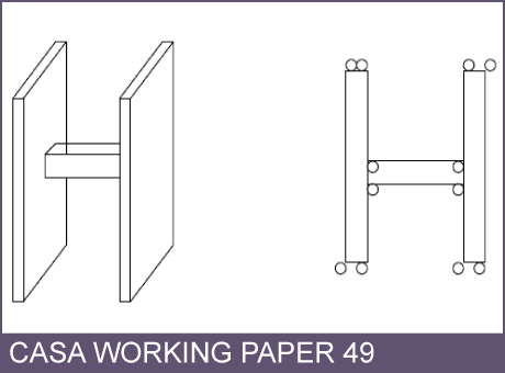
CASA Working Paper 49
CASA Working Paper 49. 1 May 2002. Multi-dimensional Modelling for the National Mapping Agency: A Discussion of Initial Ideas, Considerations, and Challenges. The Ordnance Survey, the National Mapping Agency (NMA) for Great Britain, has recently…
Centre for Advanced Spatial Analysis
CASA Working Paper 50
CASA Working Paper 50. 1 May 2002. The Impact and Penetration of Location-Based Services. The Ordnance Survey, the National Mapping Agency (NMA) for Great Britain, has recently begun to research the possible extension of its 2-dimensional geographic…
Centre for Advanced Spatial Analysis
CASA Working Paper 49
CASA Working Paper 49. 1 May 2002. Multi-dimensional Modelling for the National Mapping Agency: A Discussion of Initial Ideas, Considerations, and Challenges. The Ordnance Survey, the National Mapping Agency (NMA) for Great Britain, has recently…
Centre for Advanced Spatial Analysis
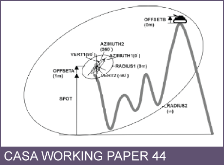
CASA Working Paper 44
CASA Working Paper 44. 1 February 2002. Optimising visibility analyses using topographic features on the terrain. The advantages of using the fundamental topographic features of a surface namely the peaks, pits, passes, ridges and channels as the…
Centre for Advanced Spatial Analysis

CASA Working Paper 30
CASA Working Paper 30. 1 July 2001. The Geometry of Slums: boundaries, packing and diversity. The geometry of squatter settlements on the northeastern coast of Brazil is examined and compared to settlements in the central region of Kenya. In…
Centre for Advanced Spatial Analysis