 Close
Close

Latest
955 results

CASA Working Paper 42
CASA Working Paper 42. 1 February 2002. Empiricism and Stochastics in Cellular Automaton Modeling of Urban Land Use Dynamics. An increasing number of models for predicting land use change in regions of rapid urbanization are being proposed and built…
Centre for Advanced Spatial Analysis

CASA Working Paper 43
CASA Working Paper 43. 1 February 2002. Surface Networks. The desire to understand and exploit the structure of continuous surfaces is common to researchers in a range of disciplines. Few examples of the varied surfaces forming an integral part of…
Centre for Advanced Spatial Analysis

CASA Working Paper 46
CASA Working Paper 46. 1 February 2002. Summary of Coral Cay Conservation's Habitat Mapping Data from Utila, Honduras. The coral reefs of Honduras are of vital national and international importance, both ecologically and economically, but are…
Centre for Advanced Spatial Analysis

CASA Working Paper 40
CASA Working Paper 40. 1 January 2002. Classification Methods for Spatial Data Representation. It is necessary to classify numerical values of spatial data when representing them on a map and visually understanding it. In consequence, loss of…
Centre for Advanced Spatial Analysis
CASA Working Paper 41
CASA Working Paper 41. 1 January 2002. Spatial Clustering Method for Geographic Data. In the process of visualizing quantitative spatial data, it is necessary to classify attribute values into some class divisions. In a previous paper, the author…
Centre for Advanced Spatial Analysis
CASA Working Paper 40
CASA Working Paper 40. 1 January 2002. Classification Methods for Spatial Data Representation. It is necessary to classify numerical values of spatial data when representing them on a map and visually understanding it. In consequence, loss of…
Centre for Advanced Spatial Analysis
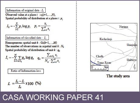
CASA Working Paper 41
CASA Working Paper 41. 1 January 2002. Spatial Clustering Method for Geographic Data. In the process of visualizing quantitative spatial data, it is necessary to classify attribute values into some class divisions. In a previous paper, the author…
Centre for Advanced Spatial Analysis

CASA Working Paper 39
CASA Working Paper 39. 1 December 2001. Examining Different Approaches to Mapping Internet Infrastructure. Over the last decade or so there has been a phenomenal growth in the use and diversity of information and communications technologies (ICTs),…
Centre for Advanced Spatial Analysis