Colouring London
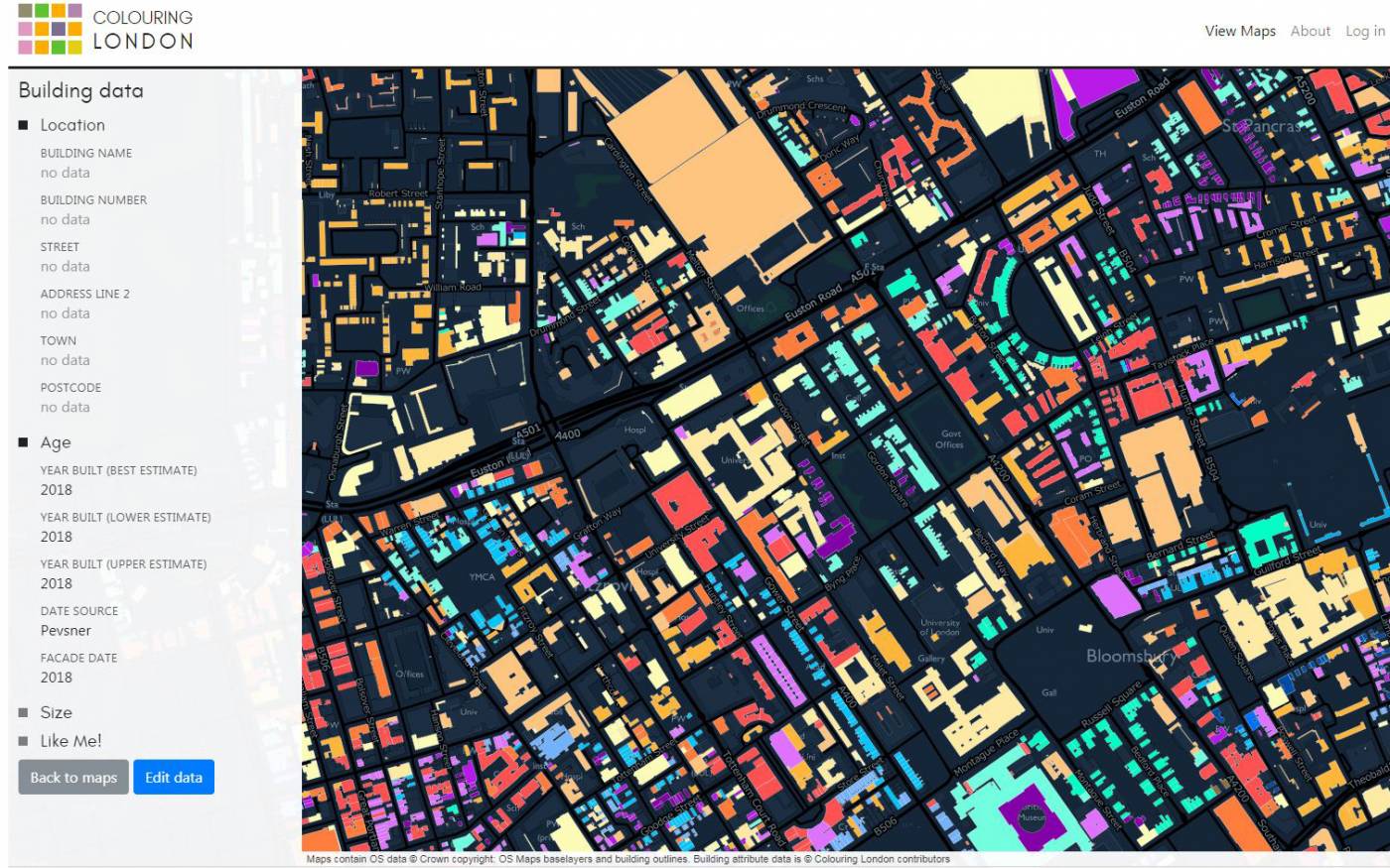
Colouring London is a web based Volunteered Geographic Information (VGI) initiative, designed by the Centre for Advanced Spatial Analysis, UCL, and created in collaboration with Historic England.

22 August 2018
Colouring London
Colouring London is being developed using building footprint data kindly provided by Ordnance Survey and facilitated by the Greater London Authority. Colouring London will provide the first ever public resource, and first port of call, for data on the characteristics of London’s building stock. Its easy-to-use web platform, designed as a reproducible model, will allow information on every London building to be collected, collated, visualised and disseminated. Approximately 12 categories of data will be crowdsourced including building age, use, type size, designation status and rebuild history. The project will also create links with the National Heritage List for England, the Greater London Historic Environment Record, and the “Layers of London” initiative.
Colouring London is funded by the Engineering and Physical Sciences Research Council (EPSRC), Historic England, the MacArthur Foundation, UCL Innovation & Enterprise, and has recently been awarded a grant by Innovate UK and The Geospatial Commission.

Colouring London builds on the growing involvement of the public in citizen science and in VGI projects such as OpenStreetMap, Galaxy Zoo and Penguin Watch. It is also inspired by the online trend for city age visualisations, created using property tax data; data to which access is restricted in the UK. Though its applications are potentially far reaching, its creation has been largely driven by the growing demand, particularly from those working in energy analysis and sustainable development, for information on the composition and long term dynamics of the building stock.
Colouring London has been developed out of PhD research within the UCL Centre for Advanced Spatial Analysis, funded by the Engineering and Physical Sciences Research Council (EPSRC). The first stage is funded by the Heritage Protection Commission’s fund run by Historic England.
To subscribe for updates on Colouring London, including news of the prototype as it launches for testing and an online exhibition about the project, visit the website.
Our Project Team
Project Supervision
Dr Duncan Smith
Project Direction, Design & Partnerships
Polly Hudson
Technical Architect & Platform Development
Tom Russell
Data Analyst & User Interface Designer
Dominic Humphreys
Senior Technician
Dr Martin de Jode
Senior Research Fellow (Platform Development)
Maciej Ziarkowski
Graphic Design/Colour Support
Louis Jobst
Thanks to Tarn Hamilton for colour advice
For press enquiries, please contact Candice Lewis. We are a small team so if you would like to comment on the site please refer any feedback and questions to our discussion threads.
 Close
Close

