Vulnerability to Meteorological Hazards
As part of the coursework requirements for the Geological, Geotechnical and Hydrometeorological Hazards module, students are asked to write articles in the style of an online blog on the topic of vulnerability to meteorological hazards. To learn more about social vulnerability to meteorological hazards, check out some of the student blogs here.
Cyclones in Myanmar: Lessons Learned and Challenges Ahead
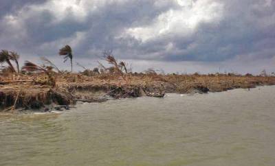
Myanmar's coastal areas face risks from intense storms, highlighting the need to reduce vulnerability.
“
From Hazard to Disaster: How did Social Vulnerability Intensify Hurricane Katrina's Impact on New Orleans?
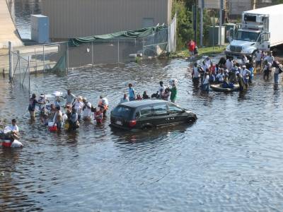
“Social inequalities ingrained in New Orleans' population, which intensified the impact of Katrina, also played a role in shaping the population's recovery.
Winds of Change: Bangladesh's Vulnerability to Tornadoes Explored
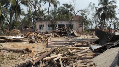
“Bangladesh has one of the highest global death rates for tornadoes despite not having the highest annual occurrence, leaving the question of why the events are so devastating?
Surviving the Storm: A Vulnerable Nation Struck by Typhoon Haiyan
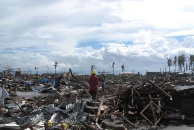
“What made the Philippines so vulnerable to the devastating impact of Typhoon Haiyan can be attributed to several factors, including economic and social status, inequality, and systemic weaknesses.“
Can a Hurricane Discriminate? Discussing the Effects of Extant Inequalities Revealed by Hurricane Katrina and the Lessons Learnt
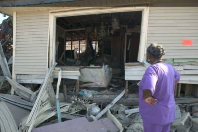
Hurricane Katrina exposed the exclusion, isolation and distress of those who were most vulnerable in American society.
Lessons from Cyclone Sidr: Addressing Vulnerability to Build Resilience in Bangladesh's Coastal Regions
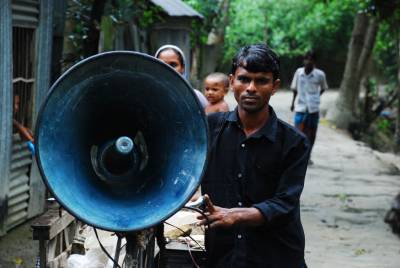
Within the last 40 years alone more than 900,000 people in Bangladesh have died due to tropical cyclones and many more have been forced to leave or rebuild their homes.“
Super Typhoons in the West Pacific
Hurricanes, or typhoons as they are known in the West Pacific, can expose the vulnerabilities of even the most well-prepared countries.
Heat Wave Vulnerability – 2019 Bihar Heat Wave
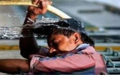
“Vulnerability to drought continues to rise in Africa’s drylands because of climate change, population growth and civil unrest, jeopardising the livelihood of generations to comeProlonged heat waves are a threat to all human society. However, they pose a serious threat to societies’ vulnerable groups.
Africa: Where Drought & Conflict Collide
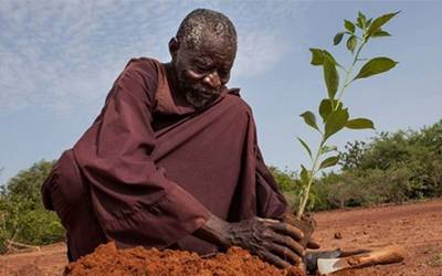
“Vulnerability to drought continues to rise in Africa’s drylands jeopardising the livelihood of generations to come.
Vulnerability to wildfire in California
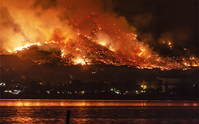
In many ways wildfire disasters can be viewed as indiscriminate, hitting all communities in their path, and the economic cost of these fires is astronomical.
Resilience to hurricanes in the Caribbean
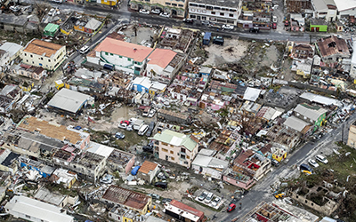

Education of the consequences of historical hurricanes provides populations with the skills to construct evacuation and damage mitigation plans.
How vulnerability can turn hazards into disasters
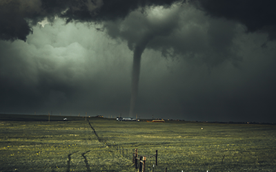

Tornadoes have always fascinated mankind. They can form in the blink of an eye and leave a trail of devastation in no time at all.
Wildfire vulnerability in the USA
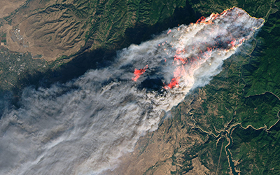
Wildfire management and the factors influencing social vulnerability must be explored together in order to create more resilient communities.
Vulnerability of California to drought
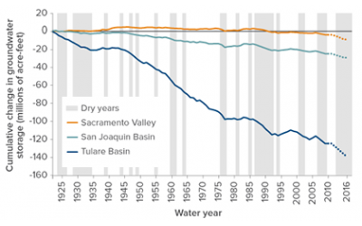
Whilst droughts in California pose a severe threat to the entire region, their impacts are felt disproportionately amongst the state’s population.
The Vulnerability of New Orleans
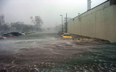
A future event on par with Hurricane Katrina is likely, yet New Orleans remains vulnerable and unprepared for such events despite its devastating history.
Cyclones in Myanmar: Lessons Learned and Challenges Ahead
by Yuwen Zhu
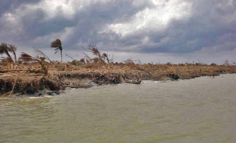
Cyclones, formidable weather systems forming over the Indian Ocean's warm seas, are a notable natural hazard in Myanmar [1]. Their formation is fueled by conditions like warm sea temperatures and atmospheric instability [1]. They cause hazards by strong winds, coastal storm surges and flooding due to heavy precipitation. Myanmar's coastline is along the Bay of Bengal, a hotspot for cyclone activity that generates 6 cyclones each year on average [2]. Regularly witnessing cyclones during specific seasons [3], Myanmar's coastal areas face risks from these intense storms, highlighting the need to reduce vulnerability.
The Worst Hit - Cyclone Nargis, 2008
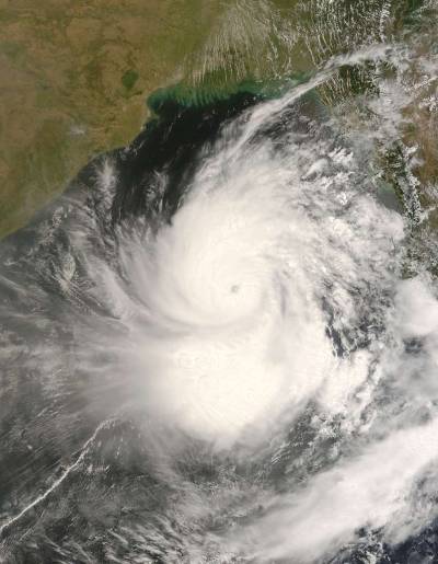
Cyclone Nargis, a devastating Category 4 cyclone, struck Myanmar's Irrawaddy River Delta in May 2008. It's remembered as the most destructive cyclone in the Indian Ocean to make landfall and the worst disaster in Myanmar [2, 4, 5] with over 140,000 lives lost, mainly from the storm surge [4, 6]. Intense winds and heavy rainfall severely impacted the delta's environment and local livelihoods [4]. The cyclone's aftermath saw widespread destruction, including damaged mangroves, saltwater-flooded fields, and significant economic losses of over $10 billion [4, 5, 6], emphasising the vulnerability to cyclones of this densely populated low-lying area in Myanmar. Why was Nargis able to cause such damage? The ultimate answer might be shocking: the country's unique political landscape.
Warning from Nargis
The crtisiced government: Myanmar's military government at the time, known as the State Peace and Development Council (SPDC), was painfully slow in responding to the devastating Cyclone Nargis, despite having the resources and organisations to act swiftly. Adding to the frustration was the SPDC's initial refusal to accept international humanitarian aid and to permit foreign aid workers into the country. This delay led to critical supplies amassing at borders as clearance for entry into Myanmar was awaited. The SPDC revealed a deep mistrust of foreign involvement. Its actions were influenced by a longstanding fear of external interference and potential armed intervention. This stance prioritised national security over humanitarian needs, as they are trained more for internal order than disaster relief. The government even prioritised a constitutional referendum over immediate disaster relief efforts, which was widely criticised. Overall, its ill-preparedness highlighted the lack of infrastructure and readiness for disaster management in Myanmar [1, 6].
Image Caption: Cyclone Nargis (2008). Source: Picryl.
The depleted environment: Cyclone Nargis highlighted the critical role of environmental factors, like mangrove depletion, in exacerbating disasters from meterological hazards. The loss of these natural defences in the low-lying coastal regions, caused by poverty-driven resource exploitation, amplified the cyclone's impact in Myanmar. The cyclone's aftermath revealed an intertwined cycle of environmental damage, poverty and disaster vulnerability, particularly in the face of climate change, which increases the frequency and intensity of such events. This scenario reflects a broader challenge: balancing immediate survival needs with sustainable environmental practices – a challenge between people and the ecosystem [4].
Urbanisation: Population growth and land-use changes are key non-climatic contributors [2]. Urban migration has led to overcrowded living conditions and a surge in informal settlements, which lack up-to-date building standards against cyclones and other hazards [3]. Historical buildings, not designed with wind hazard knowledge, house many occupants, amplifying risk [3]. The Irrawaddy Delta, housing 40 per cent of Myanmar's population and a large portion of rice production, is particularly at risk [2]. Despite updated building codes aligning with international standards, these are yet to be legally adopted [3]. Mitigating these risks is crucial for vulnerability reduction.
Measures to Reduce Vulnerability
Post Cyclone Nargis, Myanmar adopted a comprehensive approach to sustainable development, emphasising integration across sectors like food security, education, and enhancing disaster preparedness. The Tripartite Core Group, along with the UN, assessed impacts and focused on sustainable resource management. The government's commitment to a national disaster plan and the NDPCC's (National Disaster Preparedness Central Committee) reconstruction initiatives marked a significant step towards improving resilience in cyclone-prone areas [4].
Myanmar's Department of Meteorology and Hydrology (DMH) works on more effective early warnings with enhanced monitoring systems and forecasting capabilities [3]. This progress, along with the development of comprehensive cyclone hazard maps, achieved great success in cyclones after Nargis. Cyclone Giri in 2010 was the most intense storm ever to strike Myanmar. Thanks to the improvement in early warnings and subsequent evacuations, an estimated 53,000 are believed to have evacuated before the storm's arrival. It was also seen in Cyclone Mora in 2017, where early warning messages were sent to at-risk communities promptly, and subsequent emergency responses were followed up in time. Most recently, Cyclone Mocha in 2023 shows that even in the context of compounding vulnerabilities, early warnings and effective preparedness efforts saved thousands of lives [8].
However, with all these successful applications of advanced early warning and preparedness, why are the cyclones still so devastating? The answer, still, is the Myanmar’s government. Comparing the Myanmar government's response to Cyclones Nargis, Giri, and Mocha reveals a persistent issue: the government's inadequate handling of disasters. Criticisms of slow aid distribution, underreporting damages, impeding humanitarian aid and prioritising political agendas over people’s needs persisted [9]. Additionally, a new aspect of vulnerability is revealed by Mocha: the Rohingya's marginalised status and restricted access to services heightened their vulnerability, much like the general unpreparedness during Nargis [9]. Thus, while there were advancements in disaster management, the government's focus on self-preservation over transparent and effective relief efforts reflected similar shortcomings seen during Nargis. Progress and persistent challenges highlight the complex evolution of Myanmar's approach to handling natural disasters, with strides in preparedness contrasted by struggles with effective relief distribution and communication.
References
[1] Seekins, D. M. (2009). State, Society and Natural Disaster: Cyclone Nargis in Myanmar (Burma). Asian Journal of Social Science, 37, 717–737.
[2] Horton, R., De Mel, M., Peters, D., Lesk, C., Bartlett, R., Helsingen, H., Bader, D., Capizzi, P., Martin, S. & Rosenzweig, C. (2017). Assessing climate risk in Myanmar: Summary for Policymakers and Planners. New York, NY, USA: Centre for Climate Systems Research at Columbia University, WWF-US and WWF-Myanmar, UN-Habitat Myanmar.
[3] The World Bank. (2018). Review of disaster risks and structural vulnerability assessments in Myanmar. Understanding Risk.
[4] Nizar, M. (2009). Learning from Cyclone Nargis: Investing in the Environment for Livelihoods and Disaster Risk Reduction. United Nations Environment Programme.
[5] McPhaden, M. J., Foltz, G. R., Lee, T., Murty, V. S. N., Ravichandran, M., Vecchi, G. A., Vialard, J., Wiggert, J. D. & Yu, L. (2009). Ocean‐atmosphere interactions during cyclone Nargis. EOS, Transactions American Geophysical Union, 90(7), 53-60.
[6] Selth, A. (2008). Even paranoids have enemies: Cyclone Nargis and Myanmar's fears of invasion. Contemporary Southeast Asia, 30(3), 379-402.
[7] Head, J. (2012). Rebuilding Burma’s Cyclone-Hit Irrawaddy Delta. BBC News, BBC. Available at: https://www.bbc.co.uk/news/world-asia-20778768.
[8] Srivastava, A., Baker, T., Hong, S., Sarkar-Swaisgood, M. & Maruichi, D. (2023). Benefits of 'Early Warnings for All' triples in vulnerable contexts. Economic and Social Commission for Asia and the Pacific. Available at: https://unescap.org/blog/benefits-early-warnings-all-triples-vulnerable-contexts.
[9] Amnesty International. (2023). Myanmar: Military Authorities Exacerbate the Suffering Caused by Cyclone Mocha. Amnesty International Public Statement. Available at: https://www.amnesty.org.
From Hazard to Disaster: How did Social Vulnerability Intensify Hurricane Katrina's Impact on New Orleans?
by Veronica Ponz Grasa
In August of 2005, Hurricane Katrina struck the Gulf Coast of the US, resulting in the most catastrophic and costly hurricane in the country’s history [1, 2]. It claimed over 1,800 lives and damaged roughly 90,000 square miles of housing [3]. Yet, as it reached the Plaquemines Parish in Louisiana, it had diminished to a Category 3 hurricane on the Saffir-Simpson scale and its winds further weakened as it traversed New Orleans [4]. The question arises: why did the event result in such devastating consequences? ‘Vulnerability’ is the key. A natural hazard is only translated into a disaster when there is a vulnerable population or area at risk of being impacted by it. Hurricane Katrina perfectly exemplifies an event where the hazard’s geophysical processes weren’t inherently disastrous, but the impact on the area was intensified due to underlying social issues.
What made New Orleans so Vulnerable?
Hurricane Katrina hit the east of New Orleans on the 29th of August, leaving a profound impact. The population’s response differed in many ways, reflecting the social, economic and political divisions that had established and proliferated in the area over time [5]. Simply put, the most socially vulnerable were disproportionally affected. To begin with, roughly a quarter of its population lived below poverty level. Poor families have a restricted ability to respond and recover from a hazard, due to factors like older, less well-built houses, a lack of mitigation initiatives and a prevalence in small businesses that are at greater risk of being shut post-hurricane [6, 7, 8]. Then, households of racial and ethnic minorities show increased vulnerability at every phase of disaster response. Poor quality housing often serves as an indicator for both poor and ethnic minorities and is more likely to collapse during a hazardous event [9]. In New Orleans, African Americans were 4 times more likely to lose their jobs after Hurricane Katrina than white workers, all other factors equal, and 7 times more when considering income differences [5]. The city’s demographics added another layer of vulnerability; New Orleans had a higher percentage of vulnerable women, particularly poor women over 65 making up 24% of the population, compared to 12% on average on a national scale [10]. Additionally, age and disability often play a role in assessing the ability to respond to hazards and recover from disasters [11]. The elderly population in New Orleans, already above the national average, faced increased vulnerability due to disabilities.
Levees, historically safeguarding the city since the 17th century, contributed to vulnerability. In the past, due to repeated river and hurricane flooding, more and more levees were built, and pumping systems were introduced which promoted development in low-lying areas, often welcoming low-income, minority groups. Both the levees and pumping systems were inadequate and failed [10]. A lack of funding, information and poor construction had left the flood system vulnerable to failure, which accounted for the worst impacts and most deaths [12]. In essence, New Orleans' susceptibility to Katrina wasn't merely a consequence of the hurricane but a result of a complex interplay of social dynamics and governmental decisions.
Bouncing back from Katrina: Still an Unequal Process
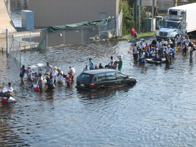
Social inequalities ingrained in New Orleans' population, which intensified the impact of Katrina, also played a role in shaping the population's recovery. The evacuation promptly reflected these disparities: 70% of the residents left before the storm, whilst 25% evacuated during or after, and 5% – predominantly African Americans – remained on-site [14]. Those with more resources tended to evacuate early while those with limited resources, mainly the poor, black, elderly or those lacking personal transportation means, sought shelter on-site or in last-resort shelters, or remained trapped in the rising floodwater. In 2005, roughly 26% of households in New Orleans did not own a vehicle [14].
Housing recovery after Katrina further illustrated the population’s underlying inequalities. The same people who lacked access to cars or proper shelter paid the price after the hurricane passed, whilst those who were the first to evacuate returned to their homes and regained water and power. In simpler terms, whilst beachfront property owners had taken a ‘forced’ vacation as power and accessibility were restored to their homes and roads, the more vulnerable struggled to return to their condemned houses with very little federal disaster relief [15]. The first neighbourhoods that recovered and were reopened were those that experienced less damage, typically located in high ground with higher property values and socially advantaged residents. On the flip side, the last neighbourhoods to reopen were in low-lying areas, where property values were lower, and residents were socially disadvantaged.
Was the Lesson Learnt?
Hurricane Katrina’s aftermath delivered a harsh truth: disasters don't rewrite societal scripts, they amplify existing social and economic narratives [16]. In fact, pre-existing social vulnerability served as an instrument for the government to create discriminatory outcomes in the recovery process.
Despite the Natural Resources Defense Council’s (NRDC) efforts for a rebuilding plan prioritizing low-income and minority groups in devastated areas, the city government favoured an approach that gave rebuilding priority to the affluent, predominantly white wards [3]. New Orleans’ mayor distanced himself from a citizen-driven reconstruction proposal, leading to program termination and to residents' mistrust and dissatisfaction with authorities. Planning staff was drastically cut after Katrina, leaving most of the recovery plans unmanaged and therefore prioritising short-term rebuilding activities, which only involved less damaged neighbourhoods [3]. Government policies facilitated the gentrification of New Orleans by prioritising the development of higher-income and tourist neighbourhoods, exemplified by the Lower Ninth Ward and its ‘forgotten survivors’, failing to address the city’s entire population comprehensively.
The key to community resilience lies in reducing its overall vulnerability before an event occurs. Regrettably, the country had failed New Orleanians long before Katrina hit them [17]. Social vulnerability must be addressed through tailored policy initiatives, avoiding a ‘one-size-fits-all’ strategy that would only exacerbate social vulnerabilities rooted in the region. Lessons from the failed levee system emphasize the need for selective development within hazard zones.
While disasters can present opportunities to improve social, economic and political conditions for affected communities, it only amplified them in the case of Katrina. To prevent history from repeating itself, a holistic approach to disaster recovery must prioritize equitable rebuilding, delving deep into pre-existing social disparities. The question remains: Have we truly learnt the lessons Katrina sought to teach?
References
[1] Cutter, S. L. & Emrich, C. T. (2006). Moral Hazard, Social Catastrophe: The Changing Face of Vulnerability along the Hurricane Coasts. The Annals of the American Academy of Political and Social Science, 604(1), 102–112. https://doi.org/10.1177/0002716205285515.
[2] McCallum, E. & Heming, J. (2006). Hurricane Katrina: an environmental perspective. Philosophical Transactions of the Royal Society A: Mathematical, Physical and Engineering Sciences, 364(1845), 2099-2115. https://doi.org/10.1098/rsta.2006.1815.
[3] Maione, C. (2019). Recovery Planning After Hurricane Katrina: A Case of Climate Justice. [online] Available at: https://deepblue.lib.umich.edu/bitstream/handle/2027.42/154718/Maione_RecoveryPlanningAfterHurricaneKatrina.pdf?sequence=1.
[4] Knabb, R. D., Rhome, J. R. & Brown, D. P. (2006). Tropical cyclone report: Hurricane katrina, august 23-30, 2005. Fire Engineering, 159(5), 32-40.
[5] Elliott, J. R. & Pais, J. (2006). Race, class, and Hurricane Katrina: Social differences in human responses to disaster. Social Science Research, 35(2), 295-321. https://doi.org/10.1016/j.ssresearch.2006.02.003.
[6] Fitts, W. (2001). Looking into the face of the storm: Small businesses. In: J. R. Maiolo, J. C. Whitehead, M. McGee, L. King, J. Johnson and H. Stone (eds.) Facing our future: Hurricane Floyd recovery in the coastal plain. Wilmington, NC: Coastal Carolina Press, 205-206.
[7] Dash, N., Peacock, W. G. & Morrow, B.H. (1997). And the poor get poorer: A neglected Black community. In: Peacock, W. G, Gladwin, H. & Morrow, B. H (eds.) Hurricane Andrew: Ethnicity, Gender and the Sociology of Disaster. London: Routledge, 206-225.
[8] Morrow, B. H. (2005). Critical business/government impact assessment.
[9] Zoraster, R. M. (2010). Vulnerable Populations: Hurricane Katrina as a Case Study. Prehospital and Disaster Medicine, 25(1), 74-78. https://doi.org/10.1017/s1049023x00007718.
[10] Laska, S. & Morrow, B. H. (2006). Social Vulnerabilities and Hurricane Katrina: An Unnatural Disaster in New Orleans. Marine Technology Society Journal, 40(4), 16-26. https://doi.org/10.4031/002533206787353123.
[11] Eldar, R. (1992). The Needs of Elderly Persons in Natural Disasters: Observations and Recommendations. Disasters, 16(4), 355-358. https://doi.org/10.1111/j.1467-7717.1992.tb00416.x.
[12] Gibbens, S. (2019). Hurricane Katrina, explained. [online] National Geographic. Available at: https://www.nationalgeographic.com/environment/article/hurricane-katrina [Accessed 21 Dec. 2023].
[13] News Muse (2005). Hurricane Katrina MS10. [online] Flickr. Available at: https://www.flickr.com/photos/newsmuse/58217636/in/photostream/ [Accessed 21 Dec. 2023].
[14] Fussell, E. (2015). The Long-Term Recovery of New Orleans’ Population After Hurricane Katrina. American Behavioral Scientist, 59(10), 1231-1245. https://doi.org/10.1177/0002764215591181.
[15] Cutter, S. L., Emrich, C. T., Mitchell, J. T., Boruff, B. J., Gall, M., Schmidtlein, M. C., Burton, C. G. & Melton, G. (2006). The Long Road Home: Race, Class, and Recovery from Hurricane Katrina. Environment: Science and Policy for Sustainable Development, 48(2), 8-20. https://doi.org/10.3200/envt.48.2.8-20.
[16] Haas, J. E., Kates, R. W. & Bowden, M. J. (1977). Reconstruction Following Disaster. The MIT Press. Chapter 6. Major Insights: A Summary and Recommendations.
[17] Corbin, T. (2015). Leveraging Disaster: Promoting Social Justice and Holistic Recovery through Policy Advocacy after Hurricane Katrina. Journal of Public Management & Social Policy, 22(2). Available at: https://digitalscholarship.tsu.edu/jpmsp/vol22/iss2/5/.
Further Reading
1. Laska, S. & Morrow, B. H. (2006). Social Vulnerabilities and Hurricane Katrina: An Unnatural Disaster in New Orleans. Marine Technology Society Journal, 40(4), 16-26. https://doi.org/10.4031/002533206787353123.
2. Zoraster, R. M. (2010). Vulnerable Populations: Hurricane Katrina as a Case Study. Prehospital and Disaster Medicine, 25(1), 74-78. https://doi.org/10.1017/s1049023x00007718.
3. Fussell, E. (2015). The Long-Term Recovery of New Orleans’ Population After Hurricane Katrina. American Behavioral Scientist, 59(10), 1231-1245. https://doi.org/10.1177/0002764215591181.
Winds of Change: Bangladesh's Vulnerability to Tornadoes Explored
by Melanie Bettles
Tornadoes are one of many meteorological hazards that Bangladesh experiences. They cover relatively small distances but have and continue to cause significant impacts [1]. Bangladesh has one of the highest global death rates for tornadoes despite not having the highest annual occurrence, leaving the question of why the events are so devastating?
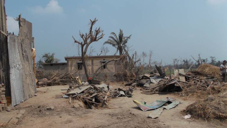
The deadliest tornado in recorded history occurred in Bangladesh on the 26th of April, 1989, and caused 1,300 fatalities, 12,000 injuries and affected 120,000 people [2, 3]. This tornado was 1.6 km wide and travelled 16 km, affecting the Manikganj district, and Saturia was the most affected sub-district [4]. Across the 153 villages that were affected, 90% of the houses were destroyed, causing an extreme increase in homelessness [4]. The damage can, in part, be attributed to this tornado being an extreme event; however, the increased vulnerability of the population in Bangladesh significantly contributed to its impact.
Influential Elements in the Vulnerability
Vulnerability is a complex concept with various definitions within the context of hazards. When assessing it in this blog, we are addressing what is sometimes referred to as social vulnerability, which can be defined as the product of the social factors and inequalities that affect a person, group or population's susceptibility to harm from a hazard, and their ability to respond to it [5]. Examples of these factors include age, ethnicity, gender and income [6]. They are sometimes limited to the demographic of the population but are more complex than this due to the intersections of the factors [7]. Vulnerability can also be difficult to access, particularly from the outside, as cultural differences in approaches to hazards can present differently in relation to vulnerability [8].
In the 1989 Bangladesh tornado, the government's disaster management policies of the time were an important constraint on vulnerability [3]. The policies were relatively young in development and had a main focus on recovery and response to hazards instead of preparedness and mitigation, with a lack of warning systems or forecasting [9]. Outside of the policy, there were not enough facilities in place to monitor tornadoes, with 28 weather stations covering an area of 56,000 miles [2, 10]. The lack of warning had a significant impact on population vulnerability, leaving them without valuable time to respond and prepare for the hazard.
75% of Bangladesh’s dense population lives in rural areas, and a large proportion of these are rural poor communities [8]. This has a high impact on other factors of vulnerability, including decreased literacy rates and access to education, and drives issues with understanding warnings or educational material [8]. Housing conditions are also affected by economic status, with the majority of rural homes in Bangladesh being weak and poorly built of bamboo, thatch, mud and corrugated iron [10]. The latter can become extremely dangerous if airborne within a tornado. The poor standard of these buildings resulted in their destruction by extreme winds, endangering the residents and increasing homelessness after the event in 1989 [3]. The lack of tornado shelters in Bangladesh further increases vulnerability, particularly with the poor quality of housing, and the rural poor cannot afford to invest in shelters. Moreover, with low-income levels, the losses and damages have significant, long-term impacts on the communities without the funds to recover rapidly from them [11].
There are significantly low levels of access to information and technology in Bangladesh, particularly in rural regions [8]. In 2005, only 6.1% of rural residents had access to a mobile phone and 0.2% to a computer and email [8]. Studies have found that tornado warnings, if issued, heavily rely on television or media communications to share the message with the public, and without these, it can further increase vulnerability without any awareness of the hazard or time to respond [12].
Individual factors, including gender, affect vulnerability, particularly in a patriarchal society like Bangladesh [4]. In Bangladesh, women are 1.24 times more likely to be injured in a tornado and were often underrepresented in the decision-making processes for disaster management [2]. Elderly and disabled populations both have increased vulnerabilities to tornadoes due to facing mobility and access issues [12]. This has been found for Bangladeshi residents over 60 facing higher chances of fatalities within tornado events [2]. This challenge opposes the short warning time and rapid response required for tornadoes [4].
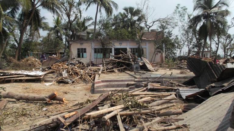
These differing factors are a small proportion of the factors that can affect vulnerability and highlight what can be considered the largest players in affecting the high fatality level of the 1989 tornado. They are incredibly interlinked, with income affecting many factors, such as literacy rates, access to adequate housing, or warning messages.
Post-event Evolution
Since the tornado in 1989 and a series of devastating natural hazards in the early 1990s, the Government of Bangladesh has changed and developed its disaster management policies [9]. This included the establishment of the Disaster Management Bureau (DMB) [4]. This shifted their focus from the response of hazards, to the mitigation and preparedness, promoting education, training, and community-level awareness and engagement with disaster management [13]. Within this, they promoted gender equality within the framework and the representation of women in disaster management to target this factor of vulnerability and reduce its impacts [9].
Since this was implemented, there has not been a catastrophic tornado event in Bangladesh, and the number of fatalities from tornadoes plateaued in the late 1990s [3]. This includes a series of severe tornadoes in Bangladesh in 2013 that occurred with low fatalities and immediate responses from the emergency services [11]. This suggests the policy changes and DMB have been successful.
However, within the policy changes, the developments in disaster management were not directed at tornadoes, and specific advancements to reduce vulnerabilities of this hazard have not been made [10]. This includes the lack of tornado shelters in rural regions and monitoring or warning system advancements. Relative decreases in loss from tornado events are evident; however, the loss is still significant to the communities affected by them [11]. Tornadoes as a hazard in Bangladesh have been neglected in the framework and benefit from the general policies, but further advancements from governing bodies to target their vulnerabilities should be made.
References
[1] Mallik, M. A. K., Alam, M. A., Chowdhury, M. A. M., Hassan, S. M. Q., Akhter, M. A. E. & Rashaduzzaman, M. (2016). Simulation of a Tornado Event on 26 April 1989 over Saturia, Manikgonj, Bangladesh using a Complete Environmental Modeling System (EMS). International Journal of Integrated Sciences & Technology, 2, 45-54.
[2] Klemm, D. W., Christian, P., & West, K. P. (2011). Epidemiology of tornado destruction in rural northern Bangladesh: Risk factors for death and injury. Disasters, 35(2), 329-345. https://doi.org/10.1111/j.1467-7717.2010.01214.x.
[3] Hosen, Md & Jubayer, A. (2016). Chronological History and Destruction Pattern of Tornados in Bangladesh. American Journal of Environmental Protection, 5(4). 71-81. https://doi.org/10.11648/j.ajep.20160504.11.
[4] Karim, N. (1995). Disasters in Bangladesh. Natural Hazards, 11, 247–258. https://doi.org/10.1007/BF00613409.
[5] Cutter, S. L., Boruff, B. J. & Shirley, W. L. (2003). Social Vulnerability to Environmental Hazards. Social Science Quarterly, 84(2), 242-261. https://doi.org/10.1111/1540-6237.8402002.
[6] Thomas, D. S. K., Phillips, B. D., Lovekamp, W. E. & Fothergill, A. (eds.). (2013). Social Vulnerability to Disasters (2nd ed.). CRC Press. https://doi.org/10.1201/b14854.
[7] Lazrus, H., B. H. Morrow, R. E. Morss & J. K. Lazo. (2012). Vulnerability beyond Stereotypes: Context and Agency in Hurricane Risk Communication. Weather, Climate and Society, 4, 103-109. https://doi.org/10.1175/WCAS-D-12-00015.1.
[8] Schmidlin, T. W. (2009). Risk factors and social vulnerability. In Preprints of the international forum on tornado disaster risk reduction in Bangladesh, Dhaka, Bangladesh. Wind Engineering Research Center, Tokyo Polytechnic University.
[9] Abdus Sabur, K. M. (2012). Disaster Management System in Bangladesh. India Quarterly. https://doi.org/10.1177/097492841106800103.
[10] Mallick, F. & Rahman, A. (2013). Cyclone and Tornado Risk and Reduction Approaches in Bangladesh. In: Shaw, R., Mallick, F., Islam, A. (eds) Disaster Risk Reduction Approaches in Bangladesh. Disaster Risk Reduction. Springer, Tokyo. https://doi.org/10.1007/978-4-431-54252-0_5.
[11] Siddiqui, R. & Hossain, T. (2013). Geographical Characteristics and the Components at Risk of Tornado in Rural Bangladesh: A Case Study of Brahmanaria Tornado. Journal of Geography and Natural Disasters, 3. https://doi.org/10.4172/2167-0587.1000111.
[12] Stough, L. M. & Mayhorn, C. B. (2013). Population Segments with Disabilities. International Journal of Mass Emergencies & Disasters, 31(3), 384-402. https://doi.org/10.1177/028072701303100306.
[13] Rahman, M. & Rahman, Md. & Rahman, M. (2017). Disasters in Bangladesh: Mitigation and Management. Barisal University Journal Part 1, 4(1). pp. 139-163.
Further Reading
1. Mallick, F. & Rahman, A. (2013). Cyclone and Tornado Risk and Reduction Approaches in Bangladesh. In: Shaw, R., Mallick, F., Islam, A. (eds) Disaster Risk Reduction Approaches in Bangladesh. Disaster Risk Reduction. Springer, Tokyo. https://doi.org/10.1007/978-4-431-54252-0_5.
2. Schmidlin, T. W. (2009). Risk factors and social vulnerability. In Preprints of the international forum on tornado disaster risk reduction in Bangladesh, Dhaka, Bangladesh. Wind Engineering Research Center, Tokyo Polytechnic University.
3. Siddiqui, R. & Hossain, T. (2013). Geographical Characteristics and the Components at Risk of Tornado in Rural Bangladesh: A Case Study of Brahmanaria Tornado. Journal of Geography and Natural Disasters, 3. https://doi.org/10.4172/2167-0587.1000111.
4. Thomas, D. S. K., Phillips, B. D., Lovekamp, W. E. & Fothergill, A. (eds.). (2013). Social Vulnerability to Disasters (2nd ed.). CRC Press. https://doi.org/10.1201/b14854.
Surviving the Storm: A Vulnerable Nation Struck by Typhoon Haiyan
by Artemis Venardos
Located along the typhoon belt, a region of the western Pacific Ocean where approximately one-third of the world's tropical cyclones develop [1], the Philippines is no stranger to typhoons. Not only is this region the most active in the world, but it also generates the most intense ones. As a matter of fact, the country experiences approximately 19-20 typhoons per year, from which 7-9 make landfall [2]. With 60% of its population residing in coastal areas and in a state of poverty, the combination of natural and social forces places the Philippines amongst the most vulnerable nations to Typhoons [3].
A Day Marked in History for the Philippines
One of the most powerful storms to make landfall in the Philippines’ recent history, was Typhoon Haiyan, which struck the country on November 8, 2013, with wind speeds exceeding 300 Km/h [4, 5]. The typhoon followed a direct path across the central Philippines, significantly impacting areas in the eastern, central and western Visayas, and northern Palawan, which happen to be amongst the most economically disadvantaged regions [4]. The storm brought, flooding in low-lying areas, a series of landslides, as well as storm surges, which surpassed 4 meters in height in Eastern and Western Samar and Leyte, resulting in massive loss of life and extensive damage to public and private property [4, 6]. A total of 4.1 million people were displaced and approximately 6,300 people died [4, 5]. The event also put a massive dent in the country's economy, with an estimated P571.2 billion (USD $12.9 billion) in damages [4, 7].
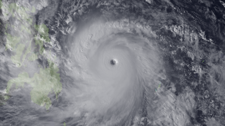
Exposed and Unprepared - Uncovering Vulnerability
What made the country so vulnerable to the devastating impact of Typhoon Haiyan, can be attributed to several factors, including economic and social status, rapid population growth, social inequality and injustice, and systemic weaknesses.
The affected areas were characterised by high levels of poverty, which exacerbated its devastating results. Economically disadvantaged households' ability to respond to and recover from typhoons was hampered by limited savings and financial resources, creating a cycle of poverty and vulnerability. The constant exposure to natural hazards has resulted in a continuous state of transient poverty in the country and has also contributed to persistent poverty [4]. In order to economically support themselves, people chose to reside in highly exposed regions to practice agriculture and fishing, the primary sources of income for the majority of poor Filipinos, including indigenous populations [6, 8], thus remaining vulnerable to losing their livelihood and homes.
Furthermore, the ongoing cycle of destruction and reconstruction, induced by typhoons, resulted in considerable losses in human capital investments, particularly in healthcare and education 4, 7], with residents displaying low-risk knowledge and many healthcare units remaining in high-risk areas [6, 9, 10]. The Visayas islands experienced rapid urbanisation and population growth, of more than 2 million people, over the decade prior to the disaster [11]. Inaccessible land led to informal settlement development with unsafe buildings and limited access to power and clean water [12]. Homes were poorly constructed with the use of lightweight materials, in dangerous areas near rivers, creeks and beaches, making them vulnerable to typhoons [12–14].
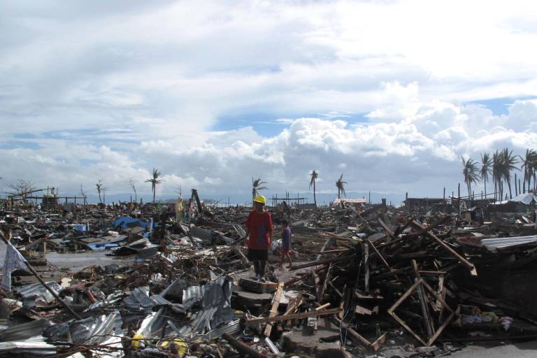
In addition, the Visayas record higher rates of physical and sexual violence compared to the national average [15]. Following Haiyan, a surge in gender-based violence, human trafficking, and commercial sex work, involving young boys and girls, was noted. People living in overcrowded evacuation centres, with limited security and privacy, were significantly vulnerable [15]. People over 60 years old were also found vulnerable due to mobility difficulties and social distancing [16].
To make matters worse, Typhoon Haiyan hit while the Visayas were already dealing with the impact of a 7.2 magnitude earthquake, which struck three weeks earlier, with many families still receiving aid and living in evacuation shelters [17]. The country's inability to achieve a speedy recovery, following disasters, further increased vulnerability in the region.
Attempts to Reduce Vulnerability
Shortly after the disaster, one of the first steps that the Filipino government took, to reduce vulnerability to future typhoons, was to push for immediate and strict implementation of 40-metre "no-build zones", inland from the coastline in high-risk areas [18]. A Resettlement Assistance Program (RAY) was also proposed, as a medium-term project, for the resettlement of 205,128 households, complying with the no-build zone of 40 metres [18].
Significant efforts were also made to safeguard people and infrastructure from future typhoons, by investing in improving early warning systems, renewing evacuation strategies, and strengthening the role of local authorities [6, 19]. In collaboration with national and international humanitarian organisations, more resilient schools, homes and evacuation centres were constructed, and livelihood and training aid was provided to farmers, fishers and livestock farmers, in order to help them recover from the tragedy [4, 6, 20]. Programmes to improve the education and dissemination of information about natural hazards, including typhoons, were also established [6].
Environmental organisations, in combination with local authorities in the Visayas, worked to restore the destroyed mangrove forests [21], which serve as natural barriers against storm surges and are essential for wildlife and fishing activities.
The United Nations Development Program (UNDP) established cash-for-work initiatives, that compensated individuals in affected areas, for assisting in response and rehabilitation efforts [4]. This not only aided in rebuilding and recovery efforts but also supplied an income for individuals who had lost their jobs.
Vulnerability Reduction Efforts Put to the Test
Nearly a decade after Typhoon Haiyan, the central regions of the Philippines were affected by Typhoon Rai, which, despite being weaker in intensity, caused comparable destruction to homes, infrastructure, and livelihoods [22]. The improved warning system, risk education efforts and the strengthened evacuation centres and schools, built in response to Typhoon Haiyan, proved to be efficient during Typhoon Rai. More than 800,000 people in the region were successfully evacuated and the overall death toll, although 409, was much lower in comparison [19].
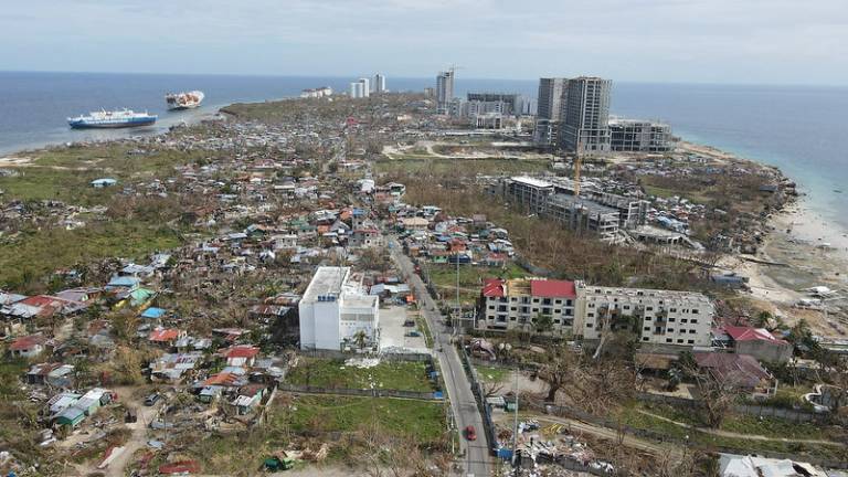
In severe contrast, the government’s 40-metre "no-build zones" and RAY program were proven to be a failure. As of 2016, only 1% of the relocation program had been completed [23], while continuous rapid population growth and urbanisation led to the development and repopulation of Informal settlements in no-build areas [18]. As a result, hundreds of thousands of people were still living in poorly constructed homes and were highly vulnerable to Typhoon Rai.
It is most certain that the Philippines will experience such destructive events in the future. Therefore, serious investments in building a more resilient and protected nation should be the Philippines’ number one priority.
References
[1] Habitat for Humanity, 2017. Response to Typhoons in the Philippines.
[2] ClimateLinks., 2017. Climate Risk Profile: Philippines.
[3] Skoufias, E., Kawasoe, Y., Strobl, E. & Acosta, P., 2020. Identifying the vulnerable to poverty from natural disasters: The case study of Typhoons in the Philippines. Economics of Disasters and Climate Change, 4, 45-82. https://doi.org/10.1007/s41885-020-00059-y.
[4] Bowen, T., 2015. Social protection and disaster risk management in the Philippines: The case of Typhoon Yolanda (Haiyan). World Bank Policy Research Working Paper No. 7482, Available at: https://ssrn.com/abstract=2688380.
[5] United Nations Institute for Disaster Risk Reduction (UNISDR), 2015. Global assessment report (GAR) on disaster risk reduction, 2015: Making development sustainable - the future of disaster risk management. 49-165.
[6] Gonzalez Rojas, A., 2019. Vulnerability Assessment Using Time Series Mapping: A Case Study of Typhoon Haiyan in Tacloban City, Philippines. Master's thesis, Harvard Extension School.
[7] Government of Philippines, 2013. Reconstruction on Yolanda (RAY): Build Back Better. Available at: https://reliefweb.int/report/philippines/reconstruction-assistance-yolanda-build-back-better.
[8] Eadie, P., Atienza, M. E. & Tan-Mullins, M., 2020. Livelihood and vulnerability in the wake of Typhoon Yolanda: Lessons of community and resilience. Natural Hazards, 103, 211-230. https://doi.org/10.1007/s11069-020-03984-z.
[9] Jibiki, Y., Kure, S., Kuri, M. & Ono, Y., 2016. Analysis of early warning systems: The case of super-typhoon Haiyan. International Journal of Disaster Risk Reduction, 15, 24–28. https://doi.org/10.1016/j.ijdrr.2015.12.002.
[10] Salazar, M. A., Law, R., Pesigan, A. & Winkler, V., 2017. Health Consequences of Typhoon Haiyan in the Eastern Visayas Region Using a Syndromic Surveillance Database. PLoS Currents, 9. 10.1371/currents.dis.4a3d3b4474847b2599aa5c5eefe3a621.
[11] Philippine Statistics Authority, 2015. 2015 Census Population.
[12] Healey, S., Lloyd, S., Gray, J. & Opdyke, A., 2022. A census-based housing vulnerability index for typhoon hazards in the Philippines. Progress in Disaster Science, 13, 100211. https://doi.org/10.1016/j.pdisas.2021.100211.
[13] Rahman, A. & Amanullah, A., 2009. Access to land and location of informal settlements in Tacloban City, Philippines. Journal of Sociology, 1, 1-13.
[14] Usamah, M., Handmer, J., Mitchell, D. & Ahmed, I., 2014. Can the vulnerable be resilient? Co-existence of vulnerability and disaster resilience: Informal settlements in the Philippines. International Journal of Disaster Risk Reduction, 10, 178–189. https://doi.org/10.1016/j.ijdrr.2014.08.007.
[15] Global Protection Cluster GBV Prevention and Response. (n.d.). Preventing Gender-Based Violence After Typhoon Yolanda; Responding to Survivors’ Needs.
[16] Kulcsar, A., 2013. Older people disproportionately affected by Typhoon Haiyan. Available at: https://www.helpage.org/news/older-people-disproportionately-affected-by-typhoon-haiyan/.
[17] Reid, K., 2018. 2013 Typhoon Haiyan: Facts, FAQs, and how to help. Available at: https://www.worldvision.org/disaster-relief-news-stories/2013-typhoon-haiyan-facts.
[18] Fitzpatrick, D. & Compton, C., 2019. Disaster Risk Reduction and the State: The Failure of No-Build Zones after Typhoon Haiyan. The Cambridge Handbook of Disaster Risk Reduction and International Law, 295-312. Cambridge University Press. https://doi.org/10.1017/9781108564540.017.
[19] OCHA, 2022. Philippines: Super Typhoon Rai (Odette) Humanitarian Needs and Priorities Revision (Dec 2021—Jun 2022) (2022). Reliefweb. Available at: https://reliefweb.int/report/philippines/philippines-super-typhoon-rai-odette-humanitarian-needs-and-priorities-revision.
[20] Reuters, 2014. Nine months on, Philippines plans $3.9-bln effort to relocate typhoon Haiyan victims. Available at: https://www.reuters.com/article/us-philippines-reconstruction-idUSKBN0G13WT20140801.
[21] Bergen, M. (n.d.). ROOTS FROM RUBBLE On Philippine coasts, rebuilding nature’s barriers to stormier seas. Available at: https://www.conservation.org/stories/roots-from-rubble.
[22] OCHA, 2022. Philippines Super Typhoon Impact Comparison. Reliefweb. Available at: https://reliefweb.int/report/philippines/philippines-super-typhoon-impact-comparison.
[23] Doyle, D., 2016. Philippines has built only 1% of homes promised after Typhoon Haiyan. Available at: https://www.thenewhumanitarian.org/news/2016/09/29/philippines-has-built-only-1-homes-promised-after-typhoon-haiyan.
Can a Hurricane Discriminate? Discussing the Effects of Extant Inequalities Revealed by Hurricane Katrina and the Lessons Learnt
by Blake O'Sullivan
Pre-Warning?
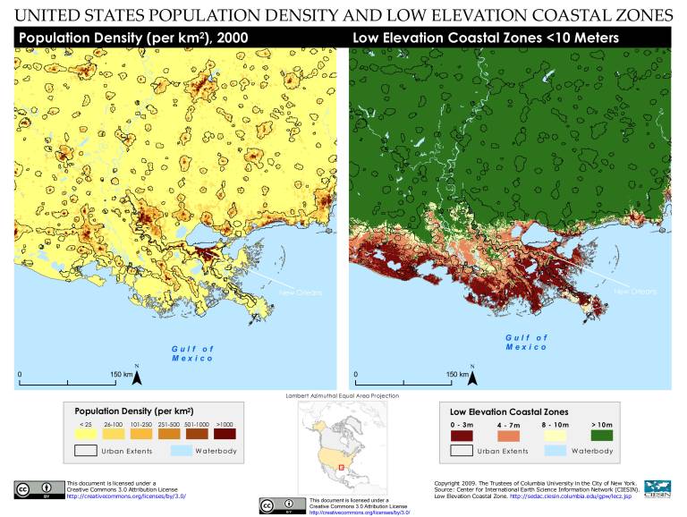
In a 2001 article in Scientific American, Mark Frischetti stated, “New Orleans is a disaster waiting to happen” [1, 2]. This was due to the Gulf Coast of the Mississippi River being prone to hurricanes and large storm surges. Although a levee system surrounded the city, New Orleans was sinking, leaving it with expensive procedures to pump the water out and environmental degradation that eliminated a portion of natural wetland barriers to meteorological events [2].
The Reveal of Inequalities
On the 29th August 2005, Hurricane Katrina hit, causing billions in damage and 1,700 fatalities with many more left unaccounted [3]. Along with it was revealed the widespread extent of environmental degradation, and institutional inequalities throughout the USA. For example, many high-risk geographical areas have disproportionately high percentages of marginalised populations, thus the same populations face multiple social disadvantages before, during and after meteorological events [4]. This was the case for New Orleans, USA. The social factors contributing to Katrina’s devastating death toll in New Orleans are numerous: funding for levees diverted to the war in Iraq; prior deployment of the Louisiana National Guard to Baghdad; lack of an evacuation plan for the poor, who primarily live in flood-prone areas; slow federal response with a focus on securing property over people; environmental degradation increasing the frequency and wrath of hurricanes and the vulnerability of the city [5].
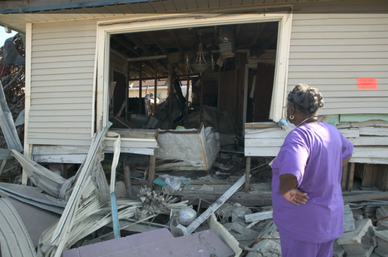
These risk factors at play exacerbated the effects of Hurricane Katrina. The disaster devasted mainly Black and poor neighbourhoods and communities in New Orleans. The damaged areas of New Orleans are disproportionately Black (46%) and below the poverty line (21%) compared to undamaged areas, 26% and 15% [5, 6]. Furthermore, 51% of pre-Katrina New Orleans residents lived in rental properties, 20% larger than the national average in the USA [7]. In tandem with evidence that renters are significantly less well preprepared to survive a disaster without injury, this severely increased the vulnerability of those within the city limits [8]. These communities also saw housing relatively uninsured against floods and thus many of the marginalised communities in New Orleans were displaced and could not afford to return to their city and homes [9].
A positive out of this event, was that evacuation was highly successful, as around 80% of the population left [10]. However, a new side of evacuation discrepancies was revealed after the event. Marginalised communities in New Orleans were often not evacuated or chose not to. What shaped the decision to remain was the social inequalities of age, gender, access to information and transportation, health and physical mobility, occupation and social networks outside the city [11]. For example, the timing of Hurricane Katrina meant that two days prior to the end of the month payday for the working class and those in receipt of Social Security and other government aid [7]. This left poorer households without funds to buy gasoline for their car so they couldn’t evacuate. In addition, collective memory of authority distrust from past experiences led to the minimisation of their perceived risk associated with Hurricane Katrina [7, 12]. This collective memory often outweighed the fears of evacuating and recovery, thus resulting in communities trusting their social network information rather than the media or authority figures [13,14].
Years of Restoration and Reconstruction
Often seen after a disaster, many politicians state to rebuild “bigger and better” during reconstruction. For New Orleans, there were three significant concepts of betterment to prevent such a disaster from happening again. First, a new smaller, but carefully planned city was proposed to revitalise older neighbourhoods and restore badly flooded neighbourhoods selected by residents [16]. This included new schools, services, and sustainable architecture that created a well-connected city using a light railway to boost commuting for work [16]. The next concept was the ‘improved city’, which focused on learning from the past by having an honest city government, a more multiracial and integrated city, and a city safe from crimes and disasters [16]. The final plan focused on an ‘invested city’ with a new economy and creative use of public and private funds to rebuild and strengthen tourism, culture, health care and the ports [16].
Although these concepts were enacted in some cases, most evacuated populations were not allowed to return home. Consequently, the timing of return mitigation coincided with spatial variability in housing recovery and social vulnerability [17]. For example, the first neighbourhoods to reopen were those of high ground, which were areas of high property values and more socially advantaged residents, and the last reopened were the low-lying areas, where property values were lower and more socially disadvantaged populations lived [17]. Furthermore, those who were homeowners received insurance payments relatively quickly and reliably, whilst those in need of federal disaster assistance through the Louisiana Road Home Program only saw payments several years after the disaster [17]. The situation was far worse for the 51% of the population who were renters. Most renters at the time were more socially disadvantaged, such as 57% being African American, 81% below-poverty line, and 62% female-headed households [17]. These residents lost access to affordable housing when the Housing Authority of New Orleans decided to redevelop four large public housing complexes for mid-income housing [18]. Therefore, the most vulnerable renters were forced out of the city. This out-migration of the more socially vulnerable residents through displacement has inferred that New Orleans is becoming “older, White, and wealthier” in the first year after Hurricane Katrina [19].
A New New Orleans
Hurricane Katrina exposed the exclusion, isolation and distress of those who were most vulnerable in American society [20]. Unfortunately, the isolation and exclusion only worsened with the city’s restoration, and the inequities between race, gender, and class have only grown. Therefore, public leadership and new partnerships are the priority for future changes.
References
[1] Fischetti, M., 2001. Drowning New Orleans. Scientific American, 285(4), 76-85. https://doi.org/10.1038/scientificamerican1001-76.
[2] Yarnal, B., 2007. Vulnerability and all that jazz: Addressing vulnerability in New Orleans after Hurricane Katrina. Technology in Society, 29(2), 249-255. https://doi.org/10.1016/j.techsoc.2007.01.011.
[3] Burchfiel, N., 2006. Update: Statistics confirm earlier report on Katrina deaths. CNS News. Available at: http://www.cnsnews.com/Nation/Archive/200601/NAT20060113a.html.
[4] Zoraster, R. M., 2010. Vulnerable populations: Hurricane Katrina as a case study. Prehospital and disaster medicine, 25(1), 74-78. https://doi.org/10.1017/s1049023x00007718.
[5] Caldwell, Jr., R. & Dubinsky, J., 2005-2006. New Orleans: The making of a social catastrophe. New Socialist Magazine , 64 (November 2005 to January 2006).
[6] Logan, J. R. & Brown University Spatial Structures in the Social Sciences (Initiative), 2006. The Impact of Katrina: Race and Class in Storm-Damaged Neighborhoods.
[7] Laska, S. & Morrow, B. H., 2006. Social vulnerabilities and Hurricane Katrina: An unnatural disaster in New Orleans. Marine technology society journal, 40(4). https://doi.org/10.4031/002533206787353123.
[8] Burby, R. J., Steinberg, L. J. & Basolo, V., 2003. The tenure trap: The vulnerability of renters to joint natural and technological disasters. Urban Affairs Review, 39(1), 32-58. https://doi.org/10.1177/1078087403253053.
[9] Henkel, K. E., Dovidio, J. F. & Gaertner, S. L., 2006. Institutional discrimination, individual racism, and Hurricane Katrina. Analyses of social issues and public policy, 6(1), 99-124. https://psycnet.apa.org/doi/10.1111/j.1530-2415.2006.00106.x.
[10] Warner, Coleman., 2005. Many made fatal choice to stay behind; Victims turned down chance to evacuate. New Orleans Times Picayune. December 27, 2005. A1.
[11] Fussell, E., 2006. Leaving New Orleans: Social stratification, networks and hurricane evacuation. Social Sciences Research Council. Available at: https://items.ssrc.org/understanding-katrina/leaving-new-orleans-social-stratification-networks-and-hurricane-evacuation/.
[12] Eisenman, D. P., Cordasco, K. M., Asch, S., Golden, J. F. and Glik, D., 2007. Disaster planning and risk communication with vulnerable communities: Lessons from Hurricane Katrina. American journal of public health, 97(Supplement_1), S109-S115. https://doi.org/10.2105%2FAJPH.2005.084335.
[13] Cordasco, K. M., 2006. The paradox of social capital as a liability in disaster management: Understanding the evacuation failure of Hurricane Katrina. Natural Hazards Observer, 30(3), 5-6.
[14] Granovetter, M., 1983. The strength of weak ties: A network theory revisited. Sociological theory, 1, 201-233. https://doi.org/10.2307/202051.
[15] Dahmen, N. S. & Miller, A., 2012. Redefining iconicity: A five-year study of visual themes of Hurricane Katrina. Visual Communication Quarterly, 19(1), 4-19. https://doi.org/10.1080/15551393.2012.656052.
[16] Kates, R. W., Colten, C. E., Laska, S. & Leatherman, S. P., 2006. Reconstruction of New Orleans after Hurricane Katrina: A research perspective. Proceedings of the national Academy of Sciences, 103(40), 4653-14660. https://doi.org/10.1073/pnas.0605726103.
[17] Fussell, E., 2015. The long-term recovery of New Orleans’ population after Hurricane Katrina. American Behavioral Scientist, 59(10), 1231-1245. https://doi.org/10.1177%2F0002764215591181.
[18] Mitchell, C. M., Esnard, A. M. & Sapat, A., 2012. Hurricane events, population displacement, and sheltering provision in the United States. Natural Hazards Review, 13(2), 150-161. https://doi.org/10.1061/(ASCE)NH.1527-6996.0000064.
[19] Frey, W., Singer, A. & Park, D., 2007. Resettling New Orleans: The first full picture from the census. Brookings Institute. Available at: https://www.brookings.edu/research/resettling-new-orleans-the-first-full-picture-from-the-census/.
[20] Turner, M. A. & Zedlewski, S. R., 2016. After Katrina: Rebuilding opportunity and equity into the new New Orleans. The Urban Institute. Available at: https://webarchive.urban.org/publications/311406.html.
Further Reading
1. Turner, M. A. & Zedlewski, S. R., 2016. After Katrina: Rebuilding opportunity and equity into the new New Orleans. The Urban Institute. Available at: https://webarchive.urban.org/publications/311406.html.
2. Yarnal, B., 2007. Vulnerability and all that jazz: Addressing vulnerability in New Orleans after Hurricane Katrina. Technology in Society, 29(2), 249-255. https://doi.org/10.1016/j.techsoc.2007.01.011.
Lessons from Cyclone Sidr: Addressing Vulnerability to Build Resilience in Bangladesh's Coastal Regions
by Linda Jakschies
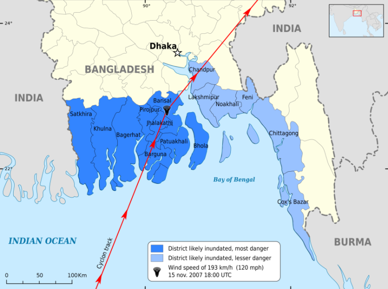
Every year in early summer and late autumn the coastal areas of Bangladesh are hit by tropical cyclones that sweep in from the Golf of Bengal. Some are capable to cause loss of life and widespread destruction due to their high wind speeds, extreme rainfall and violent storm surges, which push rising water to the coastline and inundate large extents of low-lying areas [1]. One severe cyclone was the category 4 cyclone Sidr that struck on 15 November 2007 on the southwestern coast with wind speeds of 250 km/h and 5 m surges [2, 3]. The official death toll was 3,406 and overall 2.3 million households were severely affected by the inundation of saline water which made roads impassable, knocked out electricity and communication and contaminated drinking water [1, 3].
No Disaster is Natural
Within the last 40 years alone more than 900,000 people in Bangladesh have died due to tropical cyclones and many more have been forced to leave or rebuild their homes [4]. The high exposure of the country to various natural hazards has led to the establishment of multi-layered forecasting and warning structures. In fact, the country has often been praised for its disaster preparedness especially regarding the early warning system [5]. However, landfall-making cyclones in the Northern Indian Ocean commonly still result in much higher fatalities - 2000 on average - than those in any other ocean basin worldwide up to a ratio of 1:1000 compared to the United States [1, 6]. This cannot solely be attributed to the frequency or severity of storms, but is also highly dependent on socio-economic conditions in the region that make the people living here more vulnerable. Location, pattern of settlement, income, education, access to information and supporting networks are all essential factors determining people’s vulnerability to cyclone hazards and these are highly heterogeneous in Bangladesh’s coastal areas [2, 6]. Not enough attention is paid to these aspects when studying risks emerging from cyclones even though understanding vulnerability as a social construct, that enables natural hazards to become disasters is crucial for disaster risk reduction practices to alleviate future disasters [1, 4, 7].
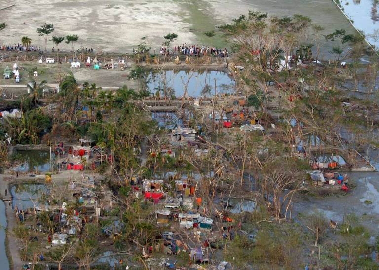
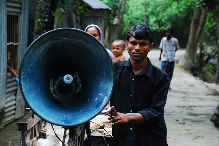
Approximately 36.6 million people live in areas along the 710 km long coastline, which constitutes 28% of Bangladesh’s population [4]. Population density is very high in this region, especially in the southwestern zone, which is one of the most densely populated regions worldwide [6]. The rapid population growth and constantly changing coastline have led to landlessness, forcing many people to settle in adverse environments like on naturally new emerging lands, the so-called ‘chars’ [1, 4]. The result is the development of unplanned settlements consisting of scattered structures often made out of straw or bamboo, which are very susceptible to cyclonic sea surge [2]. People living in these scattered and sometimes isolated settlements are more likely to be excluded from accessing information on approaching storms [2]. As the principal source of livelihood in these areas is agriculture, fishing and salt farming, people are highly dependent on the coastal and oceanic ecosystems and cyclones damaging crops, boats and fishing nets in addition to homes therefore represent threats with long lasting consequences [7, 8]. Furthermore, it means that during the peak cyclone periods farmers and fishermen are usually working out in the field or the sea, possibly being cut-off from warnings and contact to their families [2]. But surveys showed that a vast majority (75% of interviewees) had received an early warning during Sidr, however only a minor percentage of 30% took following action [6]. What other factors contributed to this hesitation?
The Gender Bias in Disasters
Long distances to cyclone shelters or lacking transport infrastructure - especially from remote char lands and when roads are damaged during storms - and a fear of theft when leaving the household were often mentioned by the affected people [1, 7]. Furthermore, gender disparities are a major problem during disasters, making women more vulnerable to natural hazards which caused a male: female death ratio of 1:5 during Sidr [7]. In very traditional communities in rural Bangladesh women are housebound and need their husband’s or guardian’s permission to leave the house which inhibits them from self-evacuating during a cyclone event [7]. Many male guardians however prefer to not move to cyclone shelters with their female family members, being concerned about a lack of privacy and the possibility of them losing their traditional dress [2]. When women successfully evacuated to shelters a majority reported harassment and lacking consideration of female needs [7]. Even in the rehabilitation stage of disasters women face different challenges from men, as they are expected to meet all their obligations like caretaking and food preparation but get inadequate support and relief materials [7].
The Way to go is Bottom-Up
Two years later Cyclone Aila hit the southwest coast again on 25 May 2009 and has put the disaster preparedness to the test while rehabilitation from Sidr was still ongoing [5]. Luckily the severity and the death toll (190) were significantly lower this time. Despite the effort of governmental and non-governmental organizations to provide humanitarian assistance immediately, short-term solutions were prioritised over the establishment of long-term resilience [5]. But progress has been made since then: In 2012 the Bangladesh Disaster Management Act was enacted, aiming to provide a legislative framework for more coordinated disaster management and adopting a more proactive rather than just reactive approach towards a more resilient nation [7, 9]. Another positive development is happening regarding the involvement of women in disaster risk reduction: female volunteers now make up 50% in the country’s Cyclone Preparedness Programme, and provide crucial contribution in spreading information about cyclones in female networks. This not only ensures a decrease in gender disparities during evacuations by giving women autonomy in their decisions, but also represents an important social transformation by empowering women through taking on such important roles, a development that hopefully emanates to other sectors [7]. So while the government’s responsibility in removing systematic inequalities that increase the vulnerability of marginalised groups shall not be neglected, it is bottom-up approaches being driven from within local communities like this that have a great potential to make a difference in reducing vulnerability to cyclone hazards in Bangladesh [8].
References
[1] Alam, A., Sammonds, P. & Ahmed, B., 2020. Cyclone risk assessment of the Cox’s Bazar district and Rohingya refugee camps in southeast Bangladesh. Science of the Total Environment, 704, 135360. https://doi.org/10.1016/j.scitotenv.2019.135360.
[2] Alam, E. & Collins, A. E., 2010. Cyclone disaster vulnerability and response experiences in coastal Bangladesh. Disasters, 34(4), 931-954. https://doi.org/10.1111/j.1467-7717.2010.01176.x.
[3] Government of Bangladesh, 2008. Cyclone Sidr in Bangladesh: Damage, loss and needs assessment for disaster recovery and reconstruction. ReliefWeb. Available at: https://reliefweb.int/report/bangladesh/cyclone-sidr-bangladesh-damage-loss-and-needs-assessment-disaster-recovery-and.
[4] Rabby, Y. W., Hossain, M. B. & Hasan, M. U., 2019. Social vulnerability in the coastal region of Bangladesh: An investigation of social vulnerability index and scalar change effects. International Journal of Disaster Risk Reduction, 41, 101329. https://doi.org/10.1016/j.ijdrr.2019.101329.
[5] Sadik, M. S., Nakagawa, H., Rahman, R., Shaw, R., Kawaike, K. & Fujita, K., 2018. A study on Cyclone Aila recovery in Koyra, Bangladesh: Evaluating the inclusiveness of recovery with respect to predisaster vulnerability reduction. International Journal of Disaster Risk Science, 9, 28-43. https://doi.org/10.1007/s13753-018-0166-9.
[6] Mallick, B. & Vogt, J., 2015. Societal dealings with cyclone in Bangladesh—a proposal of vulnerability atlas for sustainable disaster risk reduction. Journal of Coastal Zone Management, 18(3), 409-419.
[7] Alam, K. & Rahman, M. H., 2014. Women in natural disasters: A case study from southern coastal region of Bangladesh. International journal of disaster risk reduction, 8, 68-82. https://doi.org/10.1016/j.ijdrr.2014.01.003.
[8] Younus, M. A. F., 2017. An assessment of vulnerability and adaptation to cyclones through impact assessment guidelines: A bottom-up case study from Bangladesh coast. Natural Hazards, 89, 1437-1459. https://doi.org/10.1007/s11069-017-3027-8.
[9] Government of the People’s Republic of Bangladesh, 2020. National Plan for Disaster Management (2021-2025). Ministry of Disaster Management and Relief.
Further Reading
1. Ahmed, B., Orcutt, M., Sammonds, P., Burns, R., Issa, R., Abubakar, I. & Devakumar, D., 2018. Humanitarian disaster for Rohingya refugees: impending natural hazards and worsening public health crises. The Lancet Global Health, 6(5), e487-e488. https://doi.org/10.1016/S2214-109X(18)30125-6.
2. Paul, B. K. & Dutt, S., 2010. Hazard warnings and responses to evacuation orders: The case of Bangladesh's cyclone Sidr. Geographical Review, 100(3), 336-355. https://doi.org/10.1111/j.1931-0846.2010.00040.x.
Super Typhoons in the West Pacific
by Conor Rutland
Vulnerability
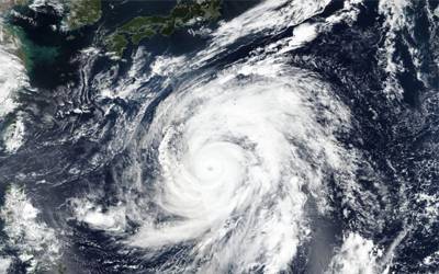
As coronavirus sweeps across the globe at the time of writing, many of whom would not have considered themselves ‘vulnerable’ two months ago are beginning to question their vulnerability to these new health concerns. It can take a dramatic event such as this for people to realise just how vulnerable they are, and the same is true when it comes to natural hazards. Hurricanes, or typhoons as they are known in the west pacific, can expose the vulnerabilities of even the most well-prepared countries, as we saw with Super Typhoon Hagibis’ impact on Japan in late 2019.
Vulnerability is a measure of how susceptible populations or individuals are to harm, injury or damage by a particular hazard. It is a complex subject, with many contributing factors that can be difficult to objectively measure. Vulnerability to typhoons can be affected by wealth, incidence of poverty, quality of education, quality of healthcare, and population density to name just a few factors. Of these, wealth and poverty are highly significant factors in reducing or increasing vulnerability, respectively, and education and healthcare become more significant in developing countries [1].
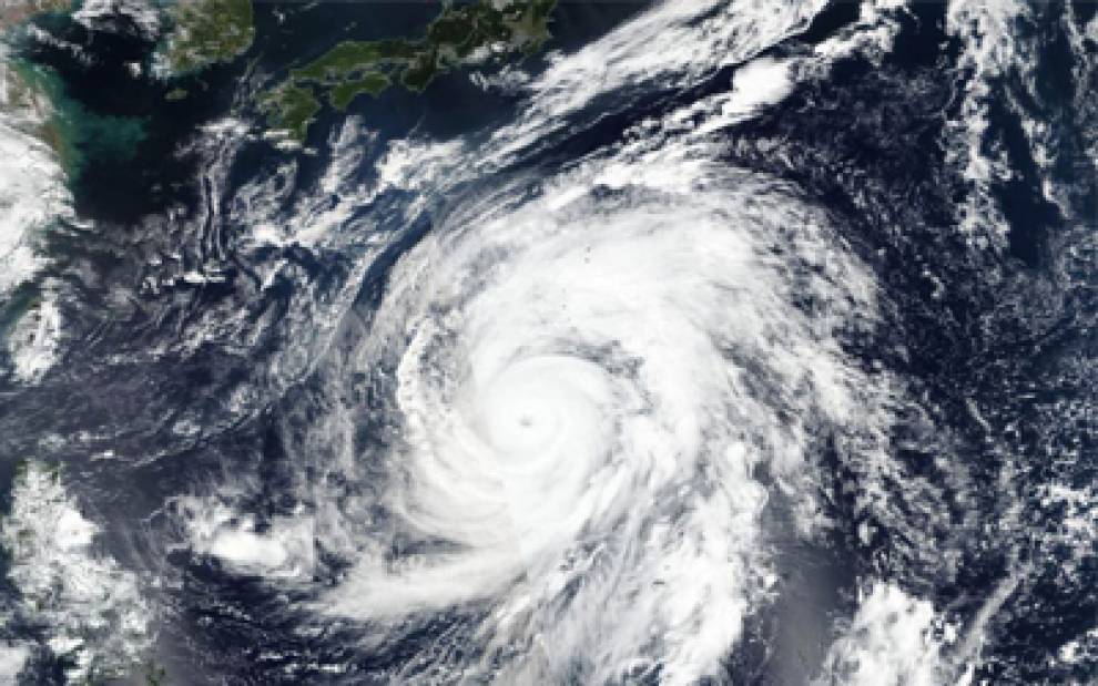
Image Caption: Super Typhoon Hagibis as it passed over the Northern Mariana Islands and headed towards Japan. Source: NASA.
A Tale of Two Archipelagos
The countries of Japan and the US Commonwealth of the Northern Mariana Islands (CNMI) are no strangers to tropical storms, with typhoons regularly bombarding the archipelagos during the western pacific typhoon season. 2019 was no exception, with Hagibis passing over both island chains, but with very different effects. When Hagibis struck, both countries were still in the midst of recovering from previous typhoons. A month prior, in September 2019, typhoon Faxai, a Cat. 4 storm, had caused widespread disruption in Japan. 3 died and over 100 more were injured, whilst 30 000 homes were damaged [2], 935 000 were left without power and over 16 000 were left without a water supply [3].
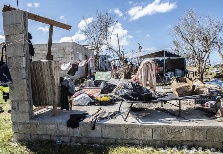
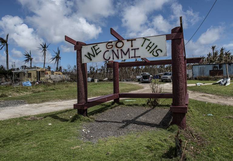
Image Caption: Left: A CNMI firefighter’s house as he returned, 3 days after Yutu. Right: A display of the islanders’ spirit following the devastating storm. Source: 15 Wing.
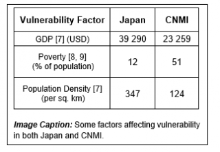
These two events in the lead up to Hagibis exposed vulnerabilities in both countries. Japan is, in many ways, the least vulnerable of the two countries. Exposed was mainly the physical vulnerability of structures, but also the vulnerability of infrastructure such as power and water supplies. Most of those with damage to their homes could recover in due time, and insurance policies would mean they are protected against the financial effects.
In CNMI, vulnerability of housing and infrastructure is initially very apparent, but it is the less obvious vulnerabilities that make recovering from disaster even more difficult. The falling economy due to lack of tourism, and political vulnerability stemming from its reliance on the US mean that a year on, as Hagibis begins to form, CNMI is in an extremely vulnerable state.
Super Typhoon Hagibis
In early October 2019, Hagibis began to form. Concern grew about the storm as it grew from a tropical storm to a Cat. 5 hurricane in under 24 hours, prompting meteorologists were keeping a close eye on its development [10].
Evacuations were ordered on CNMI and nearby Guam, and government advised others to remain indoors [11], as the countries prepared for the worst. Thousands on CNMI were still living in tents or group shelters following Yutu, and so were left extremely vulnerable to the incoming storm. However, the eye of Hagibis passed over an uninhabited island in the chain, and the majority of damage was limited to fallen trees. The locals call this level of typhoon a “banana storm” [12]. The same would not be said when Hagibis struck Japan in the following days.
As Hagibis approached the Japanese islands, 7 million were ordered to leave their homes as a level 5 situation was called by the government. People flocked to supermarkets to hoard supplies where they could, though many of Japan’s aging population may not have had this luxury without the help of friends and family members [2]. Thousands of tourists in Japan for the rugby world cup were left stuck in the country, confined to their hotel rooms as fixtures were cancelled.
The storm swept through Japan, leaving 91 dead, 4 missing, and over 93 000 homes and structures were damaged, leading to an economic loss of over 10 billion USD [13], and estimated insured losses of over 15 billion USD [14]. One of the 91 dead was Sachiko Suzuki, whose grandson found her on the ground floor of her house, as she was unable to climb the stairs to escape the rising floodwater. Urban areas were more vulnerable to flooding, such as around the Abukuma river where Suzuki lived, as roads did not allow water to soak into the ground [15]. The Japanese government have since reviewed their disaster prevention policies [16].
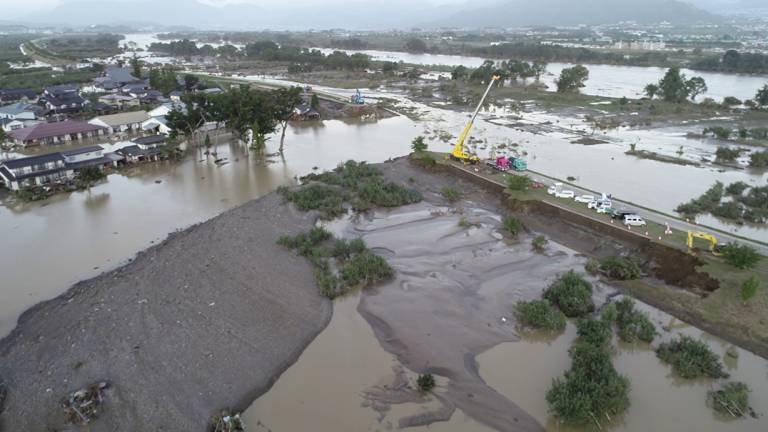
Image Caption: The overflowing banks of the Chikuma river, near Nagano city in Japan, following Hagibis in October 2019. Source: Wikipedia.
A 15-Billion-Dollar Banana Storm
Whilst those living in wealthy countries may be under the impression that they are not vulnerable, this is not the case. Even a country as well prepared for natural hazards as Japan is still vulnerable to them. It is often exposure to a hazard such as Hagibis that uncovers these vulnerabilities. It is exposure that led the extremely vulnerable North Marina Islands, recovering from Yutu’s devastation a year prior, to escape with a “banana storm”, where Japan faced the second most costly typhoon the western pacific has ever seen.
References
[1] Yonson, R., 2015. Vulnerability to Tropical Cyclones: The Case of the Phillippines. Victoria University of Wellington, New Zealand.
[2] BBC, 2019. Typhoon Hagibis: Japan suffers deadly floods and landslides from storm.
[3] The Japan Times, 2019. Japan may give Typhoon Faxai ‘severe’ designation to release more state funds for storm-hit areas.
[4] Mooney, C., Eilperin, J. & Chiu, A., 2018. Category 5 typhoon Yutu devastates the Northern Marianas in worst storm to hit any part of U.S. since 1935. The Washington Post.
[5] Perez, J., 2019. FEMA estimates $135M for NMI. Saipan Tribune.
[6] Wong, A. & Cruz, L., 2018. The Media Barely Covered One of the Worst Storms to Hit U.S. Soil. The Atlantic.
[7] The World Bank, 2020. Countries and Economies.
[8] Lu, J., 2018. 10 Facts About Poverty in Japan. The Borgen Project.
[9] Lux, M., 2016. Poverty in the Northern Mariana Islands. The Borgen Project.
[10] NASA Earth Observatory, 2019. Super Typhoon Hagibis.
[11] Guam Homeland Security, 2020. Typhoons.
[12] Radio New Zealand, 2019. Typhoon Hagibis: Eye of storm passes through Northern Marianas.
[13] Insurance Journal, 2019. Typhoon Hagibis to cost Japan’s Economy $10B, with Insured Losses in Billions: Aon.
[14] Aon, 2019. Global Catastrophe Recap.
[15] Yotsumoto, J., 2019. What’s behind the tragedy of Typhoon Hagibis? NHK World, Japan.
[16] NHK World, Japan, 2019. Typhoon Hagibis and its aftermath.
Heat Wave Vulnerability – 2019 Bihar Heat Wave
by Katie Ball
Prolonged heat waves are a threat to all human society. However, they pose a serious threat to societies’ vulnerable groups. And the threat of these dangerous heat waves is likely to become more pronounced, as global temperatures continue their upwards rise. The IPCC reported that the frequency of heat waves increased towards the end of the 20th century, and their projections show that they are likely to continue to increase in both frequency, intensity and duration worldwide, which could lead to increases in heat related mortalities [1, 2]. In 2019, regions of India and Pakistan experienced a severe heat wave, lasting for 32 days. With temperatures soaring to a near record of 50.8 degrees Celsius in some parts, vulnerable communities were impacted hard [3].
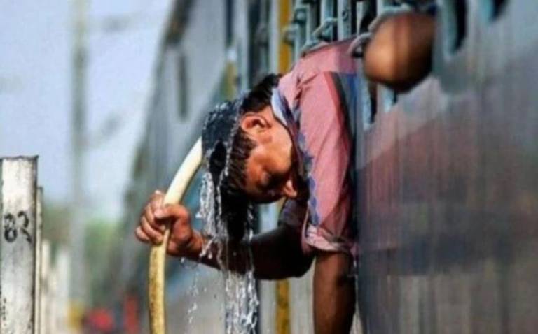
Image Caption: 2019 Bihar Heat Wave. Source: PTI/Representational image / India Today.
Why are Heat Waves Deadly?
Most of us are aware that heat waves can have a deadly impact on parts of society when they occur for prolonged periods of time. Extreme heats can rapidly become deadly when temperatures overwhelm a person’s ability to control their body temperature or thermoregulate [2]. They tend to be more deadly to certain groups of society such as older adults and younger children, as well as people with certain medical conditions.
In addition to these groups, urban populations are thought to be more vulnerable to extreme heat due to the “urban heat island” effect [4]. As shown in the figure below, this is where urban environments experience enhanced air temperatures due to urban surfaces being less able to release heat compared to rural areas, as well as more anthropogenic heat being produced in these more central areas. These warmer temperatures mean that cities are often more sensitive to the effects of heat waves.
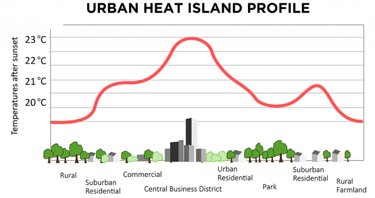
Image Caption: Urban Heat Island graphic. Source: Metlink.
Around the world, heat waves have been related to high rates of mortality whether in developing or developed countries. Take the European Heat Wave of 2003 for example, where around 35,000 people lost their lives as a result of the intense heat [5]. However, studies show that developing countries are often hit harder by the effects of high temperatures, due to the lack of socio-economic development including healthcare, education, water access, shelter and air conditioning, all of which can help save lives in the event of a heat wave [6].
India is not unfamiliar with heat waves and since 2004, they have experienced 11 of the 15 warmest years on record [7]. Steps have been taken by the Indian Government to try and curb the impacts of these events and these include reducing school days, distribution of free water and opening parks in the daytime to allow people to find shade [8]. However, in May and June 2019, regions of India and Pakistan became crippled by the soaring temperatures, reaching nearly 51 degrees Celsius, and as a result around 184 people died in Bihar.
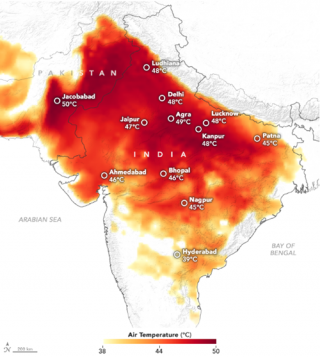
What made things worse was that there was little rainfall during the pre-monsoon season in this region - India’s population was already vulnerable. There was an extreme water shortage, with reservoirs; which would normally serve millions of people, completely drying out. To add to this, the monsoon was then delayed, making the heat even more intolerable [7]. The figure below shows sweltering temperatures in India and Pakistan during this time. Due to severe water scarcity, conflicts were breaking out as people fought for the little water available. It’s also thought that the extreme heat may have been responsible for an outbreak of Acute Encephalitis Syndrome in the region, which went onto kill over 100 children. These impacts were noted to be caused by extreme heat as well as malnutrition and a lack of awareness campaigns [9].
Image Caption: Temperatures in India and Pakistan in May/June 2019. Source: NASA Earth Observatory image by Joshua Stevens.
Steps Introduced
Heat waves are becoming more prominent in many regions of Asia. However, with time, the awareness of their impacts is being better understood and efforts are being made to communicate these impacts to the vulnerable parts of society. The Indian National Disaster Management Authority aims to keep heat related deaths down into single digits [10]. They introduced measures to tackle the impacts of extreme heat in their guidelines – “Prevention and Management of Heat Wave”. In this, it states measures including putting up display boards with colour coded heat wave alerts, installing temporary kiosks for shelter, and adding heat wave mitigation management to the school curriculum [11]. Government workers are also tasked with going out and spreading the warning measures and awareness campaigns for these events.
It’s believed that these measures are becoming more common and are helping reduce the number of heat related mortalities, however in 2019, the countries national election efforts are thought to have had a knock on effect in the number of deaths, as this took away government workers from their role of distributing heat wave awareness measures [10].
Future with India’s Warming Climate
Rising heat poses a big issue to India as its warming climate is likely to lead to more extreme heat events. It looks like the government are aware of the issues that heat waves produce and are working hard on creating and implementing strategies in order to cope with similar events in the future. Although the 2019 Bihar heat wave did have a death toll greater than single digits, it’s likely the number of fatalities could have been more without some of the efforts that were made to cope with the extreme temperatures. In hope, as the country understands better the impact of these extreme events and are better prepared to deal with them, people should be better prepared to cope with their effects. However, it’s hard to tell whether these measures will be enough to help reach and save some of India’s most vulnerable communities.
References
[1] Intergovernmental Panel on Climate Change, 2007. Summary for Policymakers. In Climate Change 2007 - Mitigation of Climate Change: Working Group III contribution to the Fourth Assessment Report of the IPCC. Cambridge: Cambridge University Press, 1-24.
[2] Reid, C. E., O'Neill, M. S., Gronlund, C. J., Brines, S. J., Brown, D. G., Diez-Roux, A. V. & Schwartz, J., 2009. Mapping community determinants of heat vulnerability. Environ. Health Perspect., 117, 1730-1736.
[3] BBC News, 2019. India reels as summer temperatures touch 50C. Available at: https://www.bbc.co.uk/news/world-asia-india-48495492.
[4] He, C., Ma, L., Zhou, L., Kan, H., Zhang, Y., Ma, W. & Chen, B., 2019. Exploring the mechanisms of heat wave vulnerability at the urban scale based on the application of big data and artificial societies. Environ. Int., 127, 573-583.
[5] Bhattacharya, S., 2003. The 2003 European Heatwave caused 35000 deaths. New Scientist. Available at: https://www.newscientist.com/article/dn4259-the-2003-european-heatwave-caused-35000-deaths/.
[6] Norwegian Institute of Bioeconomy Research, 2019. Development may reduce heatwave impact. Phys.org. Available at: https://phys.org/news/2019-02-heatwave-impact.html.
[7] NASA Earth Observatory, 2019. Heatwave in India. NASA Earth Observatory. Available at: https://earthobservatory.nasa.gov/images/145167/heatwave-in-india.
[8] Safi, M., 2018. India slashes heatwave death toll with series of low-cost measures. The Guardian. Available at: https://www.theguardian.com/world/2018/jun/02/india-heat-wave-deaths-public-health-measures.
[9] Singh, S., 2019. Heat, lack of nutrition, awareness add to AES, Bihar kids toll over 100. Indian Express. Available at: https://indianexpress.com/article/india/heat-lack-of-nutrition-awareness-add-to-aes-bihar-kids-toll-over-100-5785552/.
[10] Mashal, M., 2019. India Heat Wave, Soaring Up to 123 Degrees, Has Killed at Least 36. The New York Times. Available at: https://www.nytimes.com/2019/06/13/world/asia/india-heat-wave-deaths.html.
[11] National Disaster Management Authority, 2019. Guidelines for Preparation of Action Plan – Prevention and Management of Heat Wave. National Disaster Management Authority. Available at: https://www.ndma.gov.in/en/ndma-guidelines.html.
Africa’s Drylands: Where Drought and Conflict Collide
by Becky Ryder
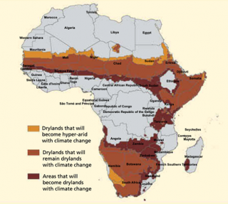
Situation Worsening due to Climate Change and Population Growth
Africa’s drylands are often gripped by extreme drought but the impacts of drought are currently being exacerbated by climate change [7] as it results in the expansion of drylands [1]. This in turn affects millions of people across the region already facing severe food shortages. In Zambia alone, 2.3 million people are experiencing severe food insecurity [8].
Population growth could also increase the number of people living in extreme environments by up to 70% by 2030 [1]. This aggravates drought vulnerability as it increases pressure on fragile and deteriorating land resources, resulting in unsustainable resource exploitation and environmental damage [3].
Image Caption: Shift and expansion of drylands area across Africa due to climate change. To show the worst-case scenario, the map reflects the fast growth scenario of greenhouse gas emissions, Representative Concentration Pathway 8.5. Source: [2].
The Rise of Climate Conflict – the Cycle between Drought and Unrest
Rapid population growth and climate change are creating conditions under which any level of extreme climate event, even a relatively localised drought, can spiral into large-scale humanitarian crises and trigger violent and lasting conflict [2]. Though the picture is far from clear, previous cases of civil war have been connected to episodes of drought, as increased competition for resources results in rising tensions [4, 7, 9]. At the end of 2018, there were 28 million new internal displacements around the world, with 61% of these being caused by natural hazards [10]. When this happens, tensions rise in the regions receiving an influx of migrants and the subsequent increased demand for resources [11]. This may provoke new conflict or intensify pre-existing conflict due to their high social and economic costs [4, 9].
Since the 2000s, conflict has broken out in Kenya, Nigeria and Chad, among many others. These conflicts disrupt livelihood activities and cause displacement, reduced health and often loss of life, continuing the cycle between drought vulnerability and social discord [2]. One impact of conflict is lowered crop yield, which reduces people’s resilience to extreme weather events, as they are forced to abandon their crops and livestock. Vulnerability is worsened as the migrants often settle in camps set up by aid workers, where disease and fighting are rampant [9].
Conflict undermines the ability of governments and non-governmental organisations to protect people from drought – a situation already worsened by the corruption that destabilises many African governments [9]. Existing schemes aiming to increase resilience to drought may be halted during times of conflict [9, 11]. These factors mean that communities have a lowered resilience to drought, therefore, future drought conditions worsen existing weaknesses in the region resulting in conflict, subsequently feeding the cycle.
Reducing Vulnerability to Drought
When communities are forced to leave their homes in search of refuge from drought, the increased pressure on existing populations leads to unrest and conflict. Civil wars in Sub-Saharan Africa have had devastating impacts on human life. In the long-term, people’s continued reliance on rainfed agriculture will keep them vulnerable to extreme weather events and in need of aid. Therefore, a reduction in conflict depends on reduced vulnerability to drought.
“Humanitarian assistance, including food assistance, is treatment, not cure [8].
It is crucial to implement structural changes that allow some people to transition to non-agricultural-based livelihood strategies. Economic growth is needed to allow this to happen, resulting in millions still reliant on rainfed agriculture [2]. Therefore, interventions need to be put in place to increase resilience; a few options are described below.
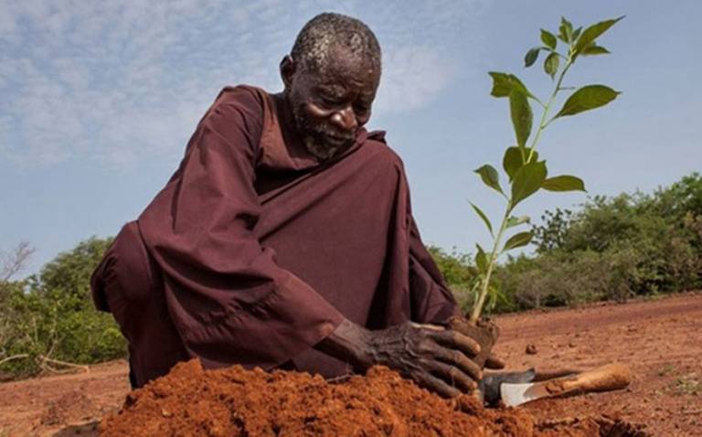
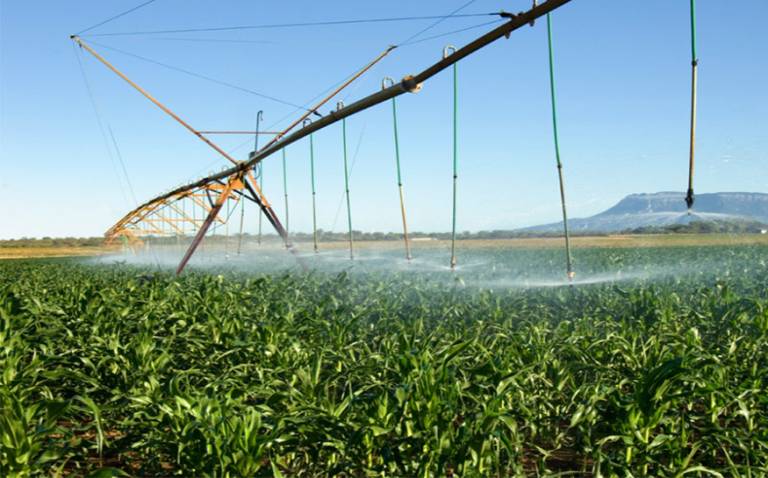
Image caption: Left: Soil fertility management through the planting of trees to increase agricultural productivity and drought tolerance of crops, resulting in an increased resilience to drought. Photo: Andrea Borgarello / World Bank [1]. Right: An irrigation system implemented on a mango farm in South Africa. Photo: Media Club South Africa [12].
One example of enhancing people’s resilience to drought would be investing in drought-resistant crop technologies such as maize [2]. Integration of such crops would stabilise crop production, allowing a continuous supply of resources [6] preventing the fluctuations in food supply and income that make these communities so vulnerable. Agricultural productivity could also be boosted by adding trees to farms. Trees add a source of fertiliser, while simultaneously increasing the tolerance of crops to drought [1, 2]. Furthermore, trees provide renewable assets that can be cut down and sold if and when needed [1]. Irrigation is one of the most important buffers against droughts, and while it is a key strategy to reduce vulnerability, irrigation development is extremely challenging across huge portions of Sub-Saharan Africa [1, 3].
Promising Future Ahead?
Severe drought in Africa’s drylands is an ongoing hazard and therefore assessing whether any measures of reducing vulnerability are successful is difficult. However, previous interventions put in place show promising results. Firstly, in Zimbabwe, the integration of drought-tolerant maize resulted in up to 600 kilograms more grain per hectares during years of extreme drought. These measures were implemented across 2.5 million ha, helping over 54 million people [6]. Despite these successes, some African countries are not benefitting from these technologies owing to legislative policies stopping farmers gaining access to improved crops [8].
If farmers introduced measures such as integration of tree species into crop fields, it is modelled to result in a 13% decrease in drought-affected people in drylands by 2030 [2]. Despite the predicted improvements, upfront costs and benefits taking many years to be felt, reduces the attractiveness to investors and farmers, as immediate needs of the local communities must be met [2, 3].
Irrigation has proved to be effective in aiding year-round crop production; however, it may not be the best technology to focus future investment on. This is because availability of water resources is intrinsically linked with climate change, and despite Africa having huge water resources located within the continent, there is huge variation is their spatial distribution [3]. Irrigation development is said to be viable on 5–9 million hectares; however, these regions are mainly located in more humid parts of the drylands [2].
Improving resilience to drought is extremely complex [2]. Therefore, it is unlikely there will be a significant improvement in the near future. As a result, right now, millions across Sub-Saharan Africa are facing severe hunger and will be for most of the next decade [13]. Undoubtably, the devastating impacts of future drought will result in widespread unrest. Now, more than ever, attention needs to be paid to the link between drought and conflict to reduce vulnerability in the future. Countless lives could be saved by reducing the impact of drought and, by extension, ending the cycle of regional tension and unrest.
References
[1] Morris, M. & Cervigni, R., 2017. In Africa’s Drylands, Opportunities to cut Vulnerability to Drought and Famine are within reach. World Bank Blogs. Available at:
https://blogs.worldbank.org/voices/africa-s-drylands-opportunities-cut-vulnerability-drought-and-famine-are-within-reach [Accessed 17 March 2020].
[2] Cervigni, R. & Morris, M. eds., 2016. Confronting drought in Africa's drylands: Opportunities for enhancing resilience. The World Bank.
[3] Shiferaw, B., Tesfaye, K., Kassie, M., Abate, T., Prasanna, B. M. & Menkir, A., 2014. Managing vulnerability to drought and enhancing livelihood resilience in sub-Saharan Africa: Technological, institutional and policy options. Weather and Climate Extremes, 3, 67-79.
[4] Steinfeld, C., 2019. Drought-related conflicts in Sub-Saharan Africa in a context of climate change. Doctoral Dissertation, University of Geneva.
[5] Bhavani, R., Vordzorgbe, S., Owor, M. & Bousquet, F., 2008. Status of disaster risk reduction in the sub-Saharan Africa region. The World Bank.
[6] Kropff, M., 2020. In new hostile climate, drought-tolerant crops, systems needed on unprecedented scale. Sci Dev Net. Available at: https://www.scidev.net/global/agriculture/opinion/in-new-hostile-climate-drought-tolerant-crops-systems-needed-on-unprecedented-scale.html [Accessed 17 March 2020].
[7] Couttenier, M. & Soubeyran, R., 2014. Drought and Civil War in Sub‐Saharan Africa. The Economic Journal, 124(575), 201-244.
[8] Sikapizye, L., 2019. Severe Drought Threatens Food Security In Sub–Saharan Africa - Alliance For Science. Alliance for Science. Available at: https://allianceforscience.cornell.edu/blog/2019/10/severe-drought-threatens-food-security-in-sub-saharan-africa/ [Accessed 17 March 2020].
[9] Harris, K., Keen, D. & Mitchell, T., 2013. When disasters and conflicts collide. Improving links between disaster resilience and conflict prevention. Available at: http://www. odi.org/sites/odi. org. uk/files/odi-assets/publications-opinion-files/8228.pdf.
[10] Joshi, H., 2020. Climate Change Now Displaces More People Than War, And India Should Be Worried. Quartz India. Available at: https://qz.com/india/1806064/india-vulnerable-as-climate-refugees-surge-amid-floods-droughts/ [Accessed 17 March 2020].
[11] Schaar, J., 2018. The relationship between climate change and violent conflict. International Organisations and Policy Support, Sida.
[12] Wheeling, K., 2020. Minireservoirs Could Save Farmers with Sandy Soils - Eos. Eos. Available at: https://eos.org/articles/minireservoirs-could-save-farmers-with-sandy-soils. [Accessed 16 March 2020].
[13] UN News, (2020). Sub-Saharan Africa Faces Grave Hunger Challenges In 2020: UN Food Relief Agency. Available at: https://news.un.org/en/story/2019/12/1054571. [Accessed 17 March 2020].
Vulnerability to wildfire in California
by India Ringer
The severity of wildfires in California has greatly ramped up in recent years. This shift has been linked to climate change, whether this is the case or not we have certainly seen temperatures increase and the land become drier and more prone to damaging wildfire. There are fire records in California going back to 1932; of the 10 largest fires since then, nine have occurred since 2000, five since 2010 and two in 2018 [1].
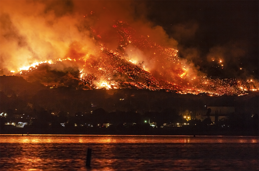
Image Caption: Wildfire in Southern California. Source: Image by Kevin Key.
The economic cost of these fires is astronomical; it’s estimated the clean-up cost of the 2018 November fires is $3 billion [2], and according to Munich Re the 15 major fires in 2018 combined cost US insurance companies $25 billion [3]. The devastating Camp Fire caused more deaths than any previous wildfire in the state. It moved at a rapid pace, burning around 80 acres per minute [4]. The Mendocino Complex Fire in July 2018 ravaged nearly 460,000 acres, surpassing the record set by 2017’s Thomas Fire [5].
In many ways these disasters can be viewed as indiscriminate, hitting all communities in their path. You only have to look at those impacted by the 2018 fires to see that these catastrophes strike across the entire state, from Northern to Southern California, and that even well-built properties cannot withstand the damage wildfire can cause. However, arguably certain areas and communities are in fact more vulnerable than others. Cities in “wildland–urban interface zones” [6] are particularly vulnerable. These are areas where houses and other structures interweave with woodland and vegetation and thus are especially prone to wildfire. Climate change is not the only factor increasing the severity of these fires, urbanisation is also having an impact. WUI areas have expanded greatly in the last 50 years, with communities moving further into forest areas. The areas hit by the Camp Fire in 2018 and the Tubbs Fire in 2017 had not previously experienced these vast and devastating fires. However, neighbourhoods and cities have greatly expanded into these areas so there has increasing amounts of infrastructure in harm’s way.
Additionally, it has been found that some communities are more vulnerable to the impact of wildfires than others. It has been shown that wildfires disproportionately affect the poor and ethnic minorities [7]. A clear example of this can be seen through the socio-economic differences between wildfire areas such as Woolsey and Camp in 2018. This demonstrates the disproportionate impact of those impacted.
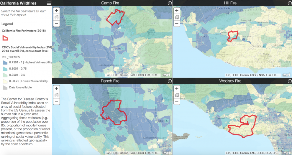
Image Caption: Maps which demonstrate the different communities impacted by the 2018 wildfires. Source: Image by Leah Squires for Direct Relief.
14% of the population within the Camp Fire perimeter live below the poverty line. This is more than double the Woolsey perimeter [7]. Low income families are less likely to have adequate insurance and thus many former Paradise residents may not be able to afford rebuilding costs. Moreover, those living in rural areas, low-income neighbourhoods, and immigrant communities are much less likely to be able to invest in fire safety which increases their vulnerability to wildfire. The impact of these inequalities can be seen after the 2017 fires in Sonoma County, California, where price gouging on rental properties heightened an already critical housing shortage [8].
Ethnic minorities are also particularly affected by wildfires. A study found that Native Americans can be hugely impacted and are in fact 6 times more vulnerable to the effects of wildfire than white people. Black and Hispanic people are about 50% more vulnerable [7]. This is in part due to the fact that the reservations tend to be located on grassland or close to woodlands, thus are more prone to wildfire. Century-old rules made it illegal to set fire to public forest land which ultimately prevented tribes from reducing the wildfire risk through controlled burns. In recent years federal agencies have engaged with tribes to carry out controlled burns in an attempt to mitigate against the risk.
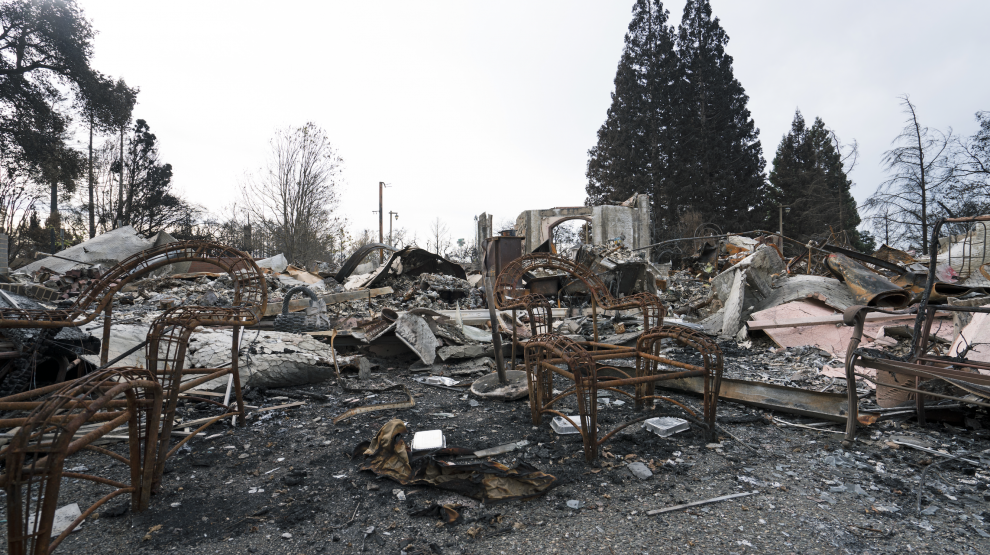
Image Caption: The destruction caused by the Sonoma & Napa Valley Wildfires in October 2017. Source: Image by Janos.
Other elements include access to a car which is clearly fundamental for evacuations, and whether individuals are fluent in English. In 2017, as three fires tore across Napa, most emergency messages were communicated in English despite 30% of Napa’s population being Hispanic [9]. These socioeconomic factors have been described as “adaptive capacity.” They are elements that make individuals more vulnerable and also with a lesser ability to cope and adapt if a disaster occurred. Dr. Bolin states that “the difference between the wealthy and the poor is the wealthy can afford losses, they have insurance, health insurance, secure jobs (typically somewhere else) and the poor don’t” [10].
“Communities that are majority black, Hispanic or Native American are over 50 percent more vulnerable to wildfire” -P. LEVIN (2018)
Overall, we can see that wildfire provides another example of how the kinds of disasters exacerbated by climate change often impact the poor and ethnic minorities the most. It’s been suggested that as global warming continues that the severity of wildfire is likely to increase. Thus its crucial to identify areas which are particularly vulnerable and may need support or funding. As Rachel Morello-Frosch, a professor at the University of California, Berkeley argues, research can “enhance the resilience of fire-prone communities, particularly for communities of color that are often overlooked when these disasters happen” [11].
References
[1] New York Times, 2018. Why Does California Have So Many Wildfires?
[2] Bustle, 2018. The Cost Of California Wildfire Damage In 2018 Is Astronomical — And It Could Keep Climbing.
[3] Los Angeles Times, 2019. California’s Camp fire was the costliest global disaster last year, insurance report shows.
[4] Wired, 2018. The Terrifying Science Behind California’s Massive Camp Fire.
[5] Business Insider, 2018. New wildfire tears through drought-stricken forest as California reels from its biggest fire in state history.
[6] RSG!: Wildland Urban Interface.
[7] Davies, I., Haugo. R., Robertson, J. & Levin, P., 2018. The unequal vulnerability of communities of color to wildfire.
[8] The New York Times, 2017. California Today: Price Gouging Complaints After the Wildfires.
[9] PRI, 2017. Many Latinos are struggling in California's wildfires, but Spanish-language information is scarce.
[10] NY Times, 2018. Minorities Are Most Vulnerable When Wildfires Strike in U.S. Study Finds.
Further Reading
1. Direct Relief: California Wildfires: Mapping Social Vulnerability (2018).
In the shadow of the USA: Improving resilience to hurricanes in the Caribbean
by Alec Godsland
Vulnerability is a concept that encompasses a variety of definitions. Independent of the severity and frequency of the hazard, it is the susceptibility of a population to experience damage, injury or economic loss due to that hazard. An essential point is that vulnerability to a particular hazard varies on an intra-locational and inter-locational basis due to the intrinsic socio-economic and geographic factors. Hurricanes display this variance particularly well, as their paths often encompass several countries, highlighting the resilience – or lack of – that different populations have to this meteorological hazard. The 2017 hurricane season was an exceptional year in the North Atlantic, breaking several records for frequency and severity of major hurricanes. This sequence, as well as previous occurrences, have shown the disparity in vulnerabilities between the Caribbean nations and the USA.
Financial Barriers
A community’s ability to reduce their vulnerability through preparation before, and recovery from, natural disasters is constrained by its financial power. Whether this is achieved through its own investment or insurance, this desired resilience requires significant capital. High levels of debt and dependence on fossil fuel imports are major impediments for Caribbean nations in achieving resilient and sustainable development. These economies lack the fiscal space to invest in risk management, but there are proven solutions to this issue. Barbados has partially alleviated its reliance on fossil fuels by offering tax benefits for the production and installation of solar water heaters [1]. Explanation of these resilience techniques to the public and investors could produce further resilience dividends, such as reduced insurance premiums.
The 2017 hurricane season was devastating to many regions that house extensive seagrass meadows, including Turks and Caicos, Puerto Rico, Cuba, the British Virgin Islands and Florida. In particular, the Turks and Caicos Islands’ lack of fertile soil makes them highly dependent on imported goods. The seagrass meadows surrounding the island are vital for marine wildlife, which underpins their main export sectors – fishing and tourism [2]. The seagrass is a habitat for marine species farmed for hotels and those species that attract marine tourism. As they move over these marine ecosystems, hurricanes rip up the flora and fauna from the seafloor, leaving the water columns full of suspended sediments that reduces growth and recovery by blocking sunlight. Whilst Florida also felt these physical effects from Irma in 2017, the dependency on this food source is far less significant as in the Caribbean [3].
![Devastation to areas of the Florida Keys (left) and St. Martin (right) by Hurricane Irma is comparable. However, the reactive resilience response is not [4]. Sources: United States Air Force and Netherlands Ministry of Defence, respectively. Devastation to areas of the Florida Keys (left) and St. Martin (right) by Hurricane Irma is comparable. However, the reactive resilience response is not [4]. Sources: United States Air Force and Netherlands Ministry of Defence, respectively.](https://www.ucl.ac.uk/earth-sciences/sites/earth_sciences/files/styles/xl_image/public/mscgeohazards-blog2-image1.png?itok=cRZ9X9P6)
Image Caption: Devastation to areas of the Florida Keys (left) and St. Martin (right) by Hurricane Irma is comparable. However, the reactive resilience response is not [4]. Sources: United States Air Force and Netherlands Ministry of Defence, respectively.
Beachfront Bombardment
Hurricanes pose a threat through a number of different hazards, but in each case, vulnerability is greatest on the coast. The low-pressure centre combined with the force of the hurricane’s winds can drive seawater onto the coast. In some cases, these storm surges can reach heights of 8m (Katrina, 2005). Low-lying coastal areas are inherently vulnerable to storm surge. For example, Anguilla, Antigua & Barbuda, Dominica, St. Kitts & Nevis, Turks & Caicos, and Netherlands Antilles will be inundated with a 3m sea level rise. Similarly, it has been estimated that 20% of the population in the Bahamas, Belize and Guadeloupe would be affected by a 6m sea level rise [5].
Likewise, the coastline of the USA is vulnerable to storm surge, notably in Louisiana, Florida, Georgia and the Carolinas. Unlike the Caribbean nations, however, the USA has the financial power to protect the most vulnerable areas. This is exhibited in New Orleans, where construction began in 1965 on a vast series of levees inspired by the flooding concerns induced by Hurricane Betsy of that year. Despite the investment and foresight, the levees were only 60-90% complete by the time Hurricane Katrina struck [6]. Catastrophic failure ensued, with flooding of 80% of New Orleans, including all of St. Bernard Parish – one of the most vulnerable areas.
In response to Hurricane Katrina and the disastrous performance of the levees, two new floodgate structures have been built – the Lake Borgne Surge Barrier and the Seabrook Floodgate. These have been constructed to reduce the susceptibility to storm surge of the most vulnerable regions, including St. Bernard Parish. The combined costs of these floodgates almost surpasses USD 900m [7] – far above the resources available to any Caribbean nation.
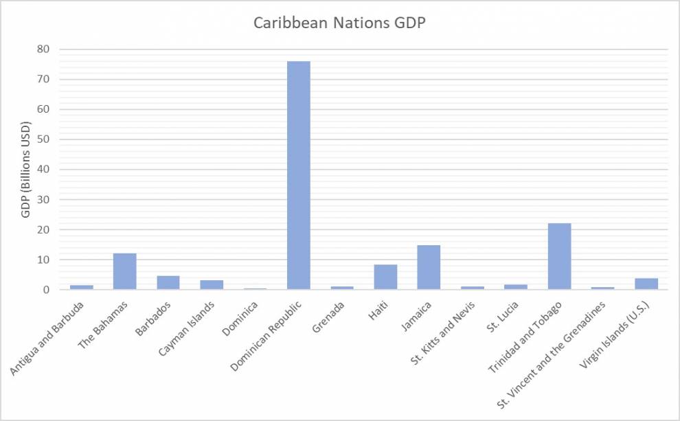
Image Caption: GDP of Caribbean nations in 2017. GDP for Cayman Islands and U.S. Virgin Islands taken from last year available, 2006 and 2015 respectively. Source: World Bank.
Resilience through Regulations
Building regulations exist to ensure any newly constructed building is sufficiently resistant to many hazards, including wind. The wind load acting on the elevations should be absorbed safely and efficiently by the building structure in order to avoid collapse. Codes such as these are often ignored in the Caribbean, as the incentives to conform are negligible. Low-income regions cannot afford the high-quality building material required or construction expertise to oversee the development. On top of these restraints, there is the need to rebuild quickly – in time for the next impending hurricane season.
Adopting building codes is a major short-term cost, requiring expenses for materials and skilled labour. However, in the long term the cost benefits can be realised in reduced reconstruction costs and allowing economies of scale in production and building. This reduction in building vulnerability directly reduces the vulnerability of the residents, as well as indirectly by making access easier for first responders and emergency supplies. The benefit is seen in the USA where these codes are strictly enforced. A study by the IBHS after Hurricane Charley in 2004 calculated that the adoptive changes to the building code in response to Hurricane Andrew reduced the number of residential property claims by 60% and the cost of claims by 42% [8].
Knowledge is Power
A vital ingredient to reducing vulnerability to hurricanes is awareness of their occurrence. This is awareness of previous effects, as well as real-time information on incoming events. Education of the consequences of historical occurrences provides populations with the skills to construct evacuation and damage mitigation plans. Access to live hurricane information allows these plans to be adapted for the current situation.
Storm surge mapping is readily available for coasts of mainland USA, Puerto Rico and the U.S. Virgin Islands. This gives residents the ability to be proactive about their potential evacuation rather than needing to react once the situation occurs by which time it might be much more difficult to organise. This access to information is in stark contrast to some Caribbean nations. According to the Population and Housing Census Report in 2001, around 30% of residents of St. Vincent had access to satellite television, less than 15% owned a computer and less than 10% had access to the internet [9].
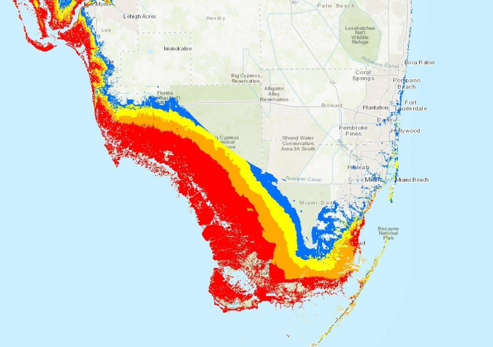
Image Caption: Storm surge vulnerability map for southern Florida. Indication of storm surge height above ground: blue - less than 3 feet; yellow - greater than 3 feet; orange - greater than 6 feet; red - greater than 9 feet. Source: The National Oceanic and Atmospheric Administration (NOAA).
Caribbean nations, haemorrhaged by continual destruction, and inundated with debt, are sailing into the wind in their attempts to build resilience to hurricanes. However, it is clear for all vulnerability comparisons that short-term investment can yield long-term gains economically. As a global population, disparities such as these must be acted on to help the most vulnerable prosper.
References
[1] Bugler, W., 2012. Seizing the sunshine: Barbados’ thriving solar water heater industry, CDKN Inside Story. London: Climate and Development Knowledge Network.
[2] Cullen-Unsworth et al., 2014. Seagrass meadows globally as a coupled social–ecological system: Implications for human wellbeing. Marine Pollution Bulletin, 83, 387-397.
[3] Djiofack, C. Z. & Velasquez, G., 2015. Caribbean trade report: the new trade environment and opportunities for the poor in the Caribbean (Vol. 2): Trade matters: new opportunities for the Caribbean. Washington, D.C.: World Bank Group.
[4] FEMA, 2017. News Release: Hurricane Irma Response and Relief Operations Continue with Full Federal Capability.
[5] Kam-Biu, L., 2002. Hurricanes and coastal zone vulnerability in Central America and the Caribbean under a changing climate [PowerPoint presentation].
[6] Army Corps of Engineers, 2005. Lake Pontchartrain and Vicinity Hurricane Protection Project. United States Government Accountability Office.
[7] Hillen, M. M., 2010. Coastal Defence Cost Estimates. Case Study of the Netherlands, New Orleans and Vietnam. The Netherlands: TU Delft.
[8] Insurance Institute for Business & Home Safety, 2018. Rating the States: 2018: An Assessment of Residential Building Code and Enforcement Systems for Life Safety and Property Protection in Hurricane-Prone Regions.
[9] Caribbean Community (CARICOM) Secretariat National Statistical Office, 2001. St. Vincent and the Grenadines - Population and Housing Census 2001.
Further Reading
1. Wilkinson, E., 2018. Towards a more resilient Caribbean after the 2017 hurricanes. [Conference Report]. Overseas Development Institute.
Tornadoes in the United States: How social vulnerability can turn a hazard into a disaster
by Phil Kreußler
If you were living in the United States and if you were to hear a tornado siren going off right now, what would you do? Surely, like most other people, you would try to avoid the tornado and to seek shelter as quickly as possible. But would you have ever asked yourself why you might be at greater risk than others, say your children, neighbour or postman? Probably not, but it is definitely worth doing because fatalities related to tornadoes show significant tendencies towards certain lifestyles.
More than Only Hot Air
Tornadoes have always fascinated mankind. They can form in the blink of an eye and leave a trail of devastation in no time. Basically, they are nothing more than spinning columns of air, but they can reach windspeeds of up to hundreds of kilometres per hour and cause severe damage to life and property. They form in big thunderstorms where uprising warm and moist air is set into rotation. If the created cloud funnel connects with the ground, a tornado is born. The US are the region most prone to tornado formation with over 1200 events in the last decade [1], simply because the environmental conditions are so favourable.
The deadliest tornado incidence happened in 1925, when the so-called tri-state tornado caused almost 700 fatalities in the states of Missouri, Illinois and Indiana [2]. Unfortunately, 9 schools were destroyed and nearly 70 students killed [3]. This disaster raises the question if there is more to the danger of a tornado than its physical properties like size and intensity only, if there are other factors which can influence the likelihood of being affected by a storm.

Image caption: Left: Typical thunderstorm that spawns a tornado. The distinct cloud funnel extends to the surface and exhibits extreme windspeeds. Photo by Nikolas Noonan on Unsplash. Right: Damage that portrays the destruction left behind in Illinois after the 1925 tri-state tornado. Photo courtesy: Jackson County Historical Society, Murphysboro, Illinois on Wikimedia.
Social Vulnerability: A Complex Measure
The answer is: Yes, there is more, much more! Social vulnerability is the concept that tries to describe the degree to which a population is susceptible to harm, injury or damage by a hazard. It focuses on life conditions and preparedness rather than on the physical impact of the hazard: For example, someone without access to transportation is more vulnerable to being affected by a hazard simply due to their lack of mobility in case of evacuation. Applying this concept to the tornado hazard in the US identifies four main components of social vulnerability: the population itself, their organisation, their living environment and their access to technology [4].
Studying the influence of a population’s characteristics reveals a few key points. Unsurprisingly, the age plays an important role. Considering the ability to move and seek shelter, the very young (under 10) are at greater risk [5] but also the middle-aged and elderly (over 40) are more vulnerable, showing a higher percentage of fatalities than their younger counterparts [6]. Conversely, there does not seem to be any major difference between the sexes: About 48% of all tornado victims are male, while roughly 44% are female. This lack of difference makes the tornado hazard unique compared with other thunderstorm-related hazards where usually a clear trend towards one of the sexes can be found [6].
Organising this population or group can also have an effect on vulnerability. A single person is much more flexible and can adapt to emergency situations more easily than a household of four or five. The more members a group has, the more effort is required to communicate warning and response effectively. Especially, significant relationships between family members and friends influence the time needed for protective action which cuts into the amount of time the group has to protect itself [4] because nobody wants to leave grandfather or the family pet behind.
But not only a population’s age and size matter, their living environment does so, too. With more and more people moving to cities, these areas become increasingly urbanised whereas rural regions become less so. Intuitively, you would expect that this would decrease urban vulnerability, but yet the opposite is the case: people living in rural areas often are more closely connected to nature and more aware of precursors to a hazard. Further, the lack of occurrence of tornadoes in big cities leads to a decay in preparedness and thus increases vulnerability [4]. A person’s mindset can also influence their coping-style, specifically persons from southern and Midwest US are more vulnerable due to their tendency for fatalism, passivity and lack of trust in warning systems [7].
Although these aspects largely contribute to tornado vulnerability, they are outweighed by the importance of technology, meaning the standard of housing in particular. In the US, so-called mobile homes (trailers, caravans) are widely used as permanent residences. Due to their focus on mobility they lack structural robustness and are vulnerable to high winds and less capable of resisting tornadoes. The numbers prove that mobile homes are not suitable as tornado shelter: An incredible 6% increase in fatalities is to be expected with every 1% increase in mobile homes [4]. Very frequently, a connection between the number of mobile homes and a population’s income is drawn. And indeed, it is plausible that people with low income tend to live in insecure shelters due to the lack of means to afford sustainable housing [4]. Unfortunately, this fact does not only apply to the tornado hazard but in general, people with less financial power and living in poor conditions are those who are most vulnerable to any natural hazard.

Image caption: Left: Example for a mobile home. These are highly vulnerable to tornadic wind damage. Photo by Angelo Pantazis on Unsplash. Right: Concept of social vulnerability to tornadic hazards in the US.
Change is the Only Constant, Let’s be Prepared!
The interplay of these components shows that a tornado hazard can be turned into a true disaster if the right (wrong) combination of circumstances is given and if a particularly vulnerable group of people like children is exposed to the event (remember tri-state tornado!). Although we understand this concept, we still experience significant loss of life from tornadic events like in 2011, when over 300 fatalities were reported following a major tornado outbreak. Ideas to improve the approach of social vulnerability include using a more complete database and considering as many demographic indicators as possible [5].
In addition to that, we should prepare for future challenges like demographic changes or climate change. It is very likely that a changing climate will impact the nature of tornadoes. Further research and more data will be required to answer these questions. In the meantime, we all should try to remain as young as possible and to live on our own, in a non-mobile home far away from the city.
References
[1] National Centres for Environmental Information (NCEI). US Tornado Climatology. Available at: https://www.ncei.noaa.gov/.
[2] Gibson, Christine., 2006. Our 10 greatest batural disatsers. American Heritage, 57(4). Available at: www.americanheritage.com/content/our-10-greatest-natural-disasters?page=show.
[3] Grazulis, Thomas P., 1993. Significant Tornadoes 1680-1991: A Chronology and Analysis of Events. St. Johnsbury, VT: The Tornado Project of Environmental Films.
[4] Donner, W. R., (2007). The political ecology of disaster: An analysis of factors influencing US tornado fatalities and injuries, 1998–2000. Demography, 44(3), 669-685.
[5] Kuster, C. & Ripberger, J., (2019). Examining Vulnerability to Tornadoes Using Census Tract-Level Demographic Data and Tornado Damage Survey Paths.
[6] Ashley, W. S., (2007). Spatial and temporal analysis of tornado fatalities in the United States: 1880–2005. Weather and Forecasting, 22(6), 1214-1228.
[7] Sims, J. H. & Baumann, D. D., (1972). The tornado threat: Coping styles of the North and South. Science, 176(4042), 1386-1392.
Wildfire vulnerability in the USA
by Inês de Araujo Muggli
Natural disasters affect billions of people worldwide, with minority and poorer communities being more vulnerable to their impacts than more affluent demographics. Over the last decade, wildfires have ravaged forests around the world causing significant damage. In the U.S., approximately 29 million Americans live in areas with high wildfire risk of which 12 million are particularly vulnerable [1]. The spread of this particularly vulnerable population is not equal across race or ethnicity, with Black, Hispanic or Native American demographics around 50% more vulnerable to wildfires than white Americans [2]. Taking vulnerability of population into consideration with wildfire occurrence when managing fire-prone landscapes could help identify areas poorly equipped to respond to wildfires in the hopes of mitigating any impacts of wildfire events. Such measures could determine whether the wildfire hazard becomes a devastating wildfire disaster.
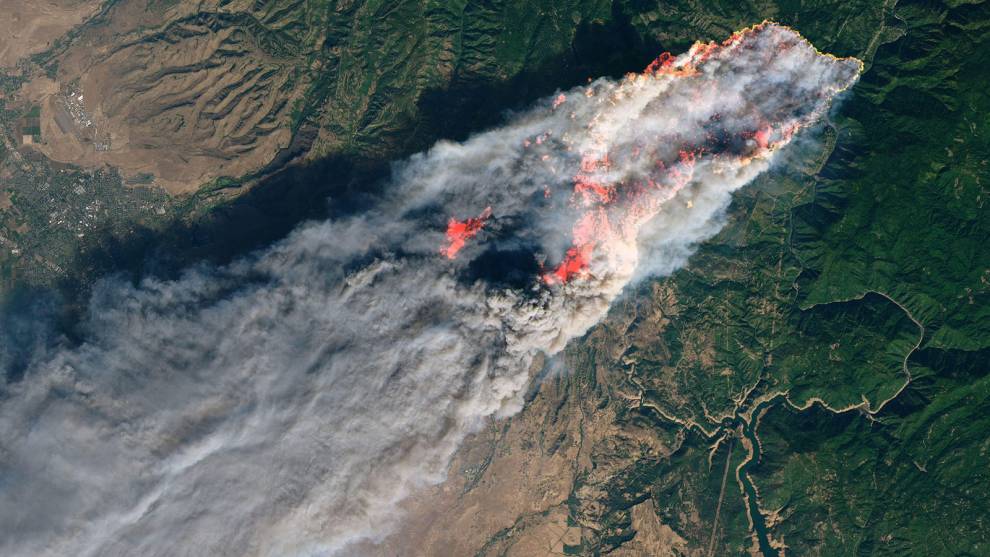
Image caption: The Camp Fire on Nov. 8 from the Landsat 8 satellite. This was the deadliest wildfire in California’s history with 71 fatalities. Source: Image from USGS/NASA/Joshua Stevens.
From a Hazard to a Disaster
Previous natural disasters in the U.S. have shown how lower-income communities can be devastatingly more vulnerable to events than more affluent populations. When Hurricane Katrina hit New Orleans in 2005, the less affluent African American community had a disproportionate amount of fatalities and property damage compared to other ethnicities. For example, 84% of missing people were African American when only 68% of New Orleans population is Black [3]. This was largely due to the fact that they did not have the means to evacuate before the hurricane struck. It is argued that it is not the hazard that is the “natural disaster” but it is the social, political and economic context i.e. the vulnerability of a population, that turns a hazard into a disaster. This was clearly the case during Hurricane Katrina and following hurricanes which have since struck, where differences in vulnerability affected the magnitude and duration of the hurricane hazard impacts e.g. loss of property and life.
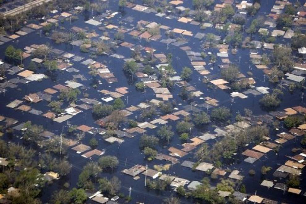
Image caption: Extensive damage in New Orleans following Hurricane Katrina. African American communities were the worst affected. Source: Image from The White House Archives.
Applying this to Wildfires
In the U.S. wildfires have had an increasing occurrence over the last few years, with California experiencing some of the deadliest and most costly forest fires in history. Mitigation strategies include tree trimming and bush removal which can create significant costs to households. Such simple measures can mean the difference between a low-severity underburn and a severe wildfire [4]. The quality of materials used to build housing also influences vulnerability with cheaper materials such as wood being much more flammable than cement. Furthermore, household renters are not eligible for federal assistance to rebuild their homes after a fire so are often left homeless [5]. Like in hurricane Katrina, less affluent populations do not have access to evacuation measures such as immediate transport nor mitigation measures such as home insurance. These are just some of the examples showing how less affluent communities are more vulnerable to wildfire hazard compared to those which are more affluent.
Since 1984, wildfires have caused 1,900 deaths, affected nearly 6 million people and cost more than $52 billion [1]. Due to their geographic locations and natural beauty areas at wildfire risk are often populated by higher-income groups, with media focus on celebrities such as Neil Young and Miley Cyrus losing their homes in the recent Woolsey fire of 2018. This often overshadows the lower-income households who lack the resources to mitigate wildfire risk. This came to light during the 2017 Sonoma County wildfires where many rural households in low-income neighbourhoods and immigrant communities could not afford insurance, rebuilding costs nor continual investment in fire safety [6]. Wildfires are a natural and necessary hazard and an underlying part of a vegetated land life cycle. However, what is an unavoidable component in many landscapes and potentially not that threatening if managed well, can turn into a billion-dollar disaster due to population vulnerability.
What can be Done?
In general, emergency planning and mitigation strategies need to take diverse populations into consideration. This could be done by engaging vulnerable groups and federal aid such as governmental “gardeners” who help less affluent communities remove underbrush and trim trees. There should also be governmental aid regarding evacuation procedures, with additional transport available.
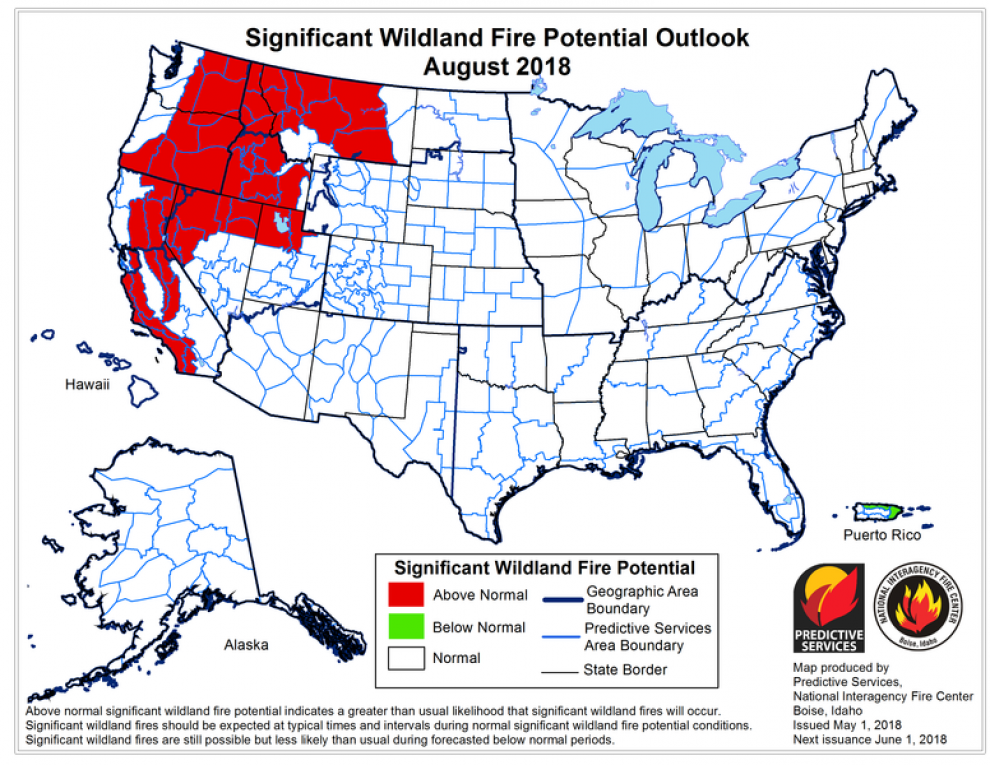
Image caption: US wildfire risk map from August 2018. Combining this with a vulnerability map would improve wildfire mitigation. Source: Image from Wikimedia.
Cultural experience with wildfires also has an impact on population vulnerability. Native American culture uses fire to manage and even enhance landscapes considering wildfires a natural process [1]. This means they have a better understanding of the risk that wildfires pose. In contrast and perhaps more relevant to the recent wildfires is the language barrier between Hispanic communities and emergency communication in areas with large Hispanic communities. During the 2014 Washington Fires, language barriers meant that Hispanic farm-workers did not receive an evacuation notification from authorities as the local Spanish radio station did not receive any emergency information [1]. During the 2017 wildfires, emergency departments and radio stations in Northern California and Santa Barbara had difficulties when releasing accurate bilingual information in time, meaning that large parts of the community did not get enough warning [7].
Wildfire disasters impact the lives of the most vulnerable populations and as such are a product of both social and ecological circumstances. The frequency of devastating wildfires is likely to increase with climate change creating warmer and drier conditions, wildland-urban interfaces experiencing more development and fire fuels continuing to accumulate [8]. Considering the variability of communities to create mitigative measures, their capacity to recover and cultural differences with wildfire experience will all contribute to reducing the impacts from wildfire disasters. It is therefore imperative that wildfire management and factors influencing social vulnerability are explored together in a “socio-ecological” manner to create more resilient communities and reduce vulnerability to wildfires.
References
[1] Doerr, S. H. & Santín, C., 2016. Global trends in wildfire and its impacts: perceptions versus realities in a changing world. Philos Trans R Soc B Biol Sci. The Royal Society, 371.
[2] Davies, I. P., Haugo, R. D., Robertson, J. C. & Levin, P. S., (2018). The unequal vulnerability of communities of color to wildfire. PloS one, 13(11).
[3] Sharkey, P., 2007. Survival and Death in New Orleans: An Empirical Look at the Human Impact of Katrina. J Black Stud, 37, 482–501.
[4] Collins, T. W., Bolin, B., 2009. Situating Hazard Vulnerability: People’s Negotiations with Wildfire Environments in the U.S. Southwest. Environ Manage. Springer-Verlag, 44, 441–455.
[5] Yonetani, M., Albuja, S., Bilak, A., Ginnetti, J., Howard, C., Kok, F., et al., 2015. Global Estimates: People Displaced by Disasters. Geneva.
[6] Collins, T. W., 2008. What Influences Hazard Mitigation? Household Decision Making About Wildfire Risks in Arizona’s White Mountains. Prof Geogr. Taylor & Francis Group, 60, 508–526.
[7] Axelrod, J., 2017. California wildfires spark issues of bilingual emergency communications. American City & County. Available at: http://americancityandcounty.com/fire/california-wildfires-spark-issues-bilingual-emergency-communications.
[8] Schoennagel, T., Balch, J. K, Brenkert-Smith, H., Dennison, P. E., Harvey, B. J., Krawchuk, M. A., et al., 2017. Adapt to more wildfire in western North American forests as climate changes. Proc Natl Acad Sci., 114, 4582–4590.
Vulnerability of California to drought in the context of a changing climate
by Duncan Sly
Conditions of prolonged and/or exceptional water scarcity, or drought, have been known to occur all across the world in many different climatic zones. However, there are certain locations where vulnerability to these extreme conditions is particularly pronounced. Perhaps the most well-known case is that of California, where the region has been repeatedly exposed to extreme weather phenomena in recent years and decades, with the state having experienced four major droughts since 1976, two of which have occurred since 2007.
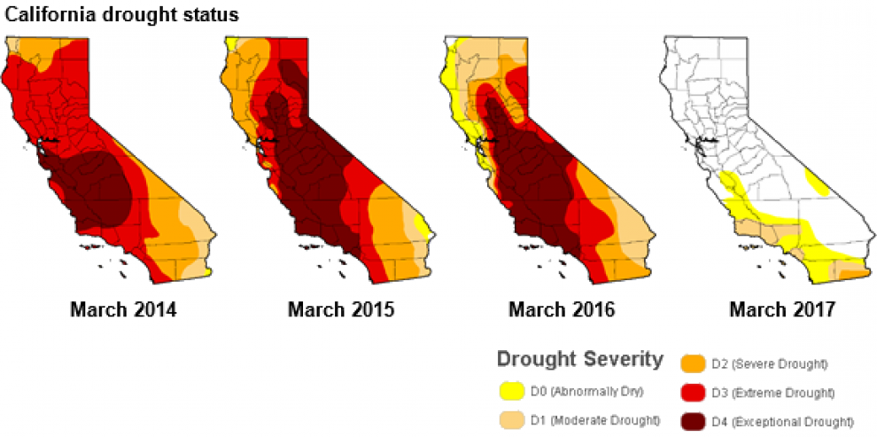
Image Caption: Extent and severity of drought conditions in California between 2014 and 2017. Source: Image by US Department of Agriculture Drought Monitor.
Population Growth and Resource Depletion
California is the most populous state in the U.S., with over 40 million inhabitants. This, in turn, has substantially raised the region’s vulnerability profile in the context of extreme weather and climate. Of course, as an area’s population increases, the rate of resource consumption also rises to compensate. For example, the state’s water consumption has doubled between 1960 and 2015, as a result of consequent increases in agricultural activity to sustain the observed population growth [1]. This trend, ultimately, is unsustainable when considering the naturally dry climatic regime of California. The region’s water supply is heavily sourced from snowpack on the Sierra Nevada, providing up to 30% of the state’s reserves each year, following winter storage from snowfall, and subsequent melting in the summer [2]. However, this historically reliable resource has become increasingly strained due to inhibited precipitation patterns in recent years owing to a warming, drying climate [3]. The ever-growing population of California is therefore left with an even lower supply of water to distribute to everyone than would be the case without the observed changes in snowpack, making the region extremely vulnerable to drought conditions.
Social Inequities in Vulnerability to Drought
Whilst droughts in California pose a severe threat to the entire region, these impacts are felt disproportionately amongst the state’s population, with ethnic minorities and low-income groups, particularly in rural areas, being most greatly affected [4]. This is because these social groups have often been found to rely on private wells for their water supply, as adequate public water services have not been established in many of these settlements [5]. For instance, communities with significant proportions of Hispanics in California were found to be recipient of lower water allowances, regardless of financial status, during the severe 2014 drought [6], indicating that such social groups have an amplified vulnerability to drought in California. This situation is compounded by the induced agricultural losses that have occurred as a result, with more than 18,000 job losses [7], exacerbating many of these communities’ water scarcity concerns. Furthermore, the disproportionate hardships endured by these social groups also has an effect on food prices across the country who depend on much of the foods and crops that are generated in California, in response to rising production costs [8].
The Case of the 2011-2017 Drought
There is no better demonstration of California’s vulnerability to drought than the sequence of events that took place between 2011 and 2017. During this prolonged drought, conditions were the driest in the region’s history, making it an unprecedented event [9]. The main causes of this can be linked to cooler-than-average sea surface temperatures in the tropical Pacific Ocean. This promoted persistent high pressure over the west coast of California, which blocked winter storms from reaching the Sierra Nevada mountains [10]. As a result, the state-wide snowpack level was as little as 6% during part of 2014, forcing the Californian government into a mandatory water use ban [11].
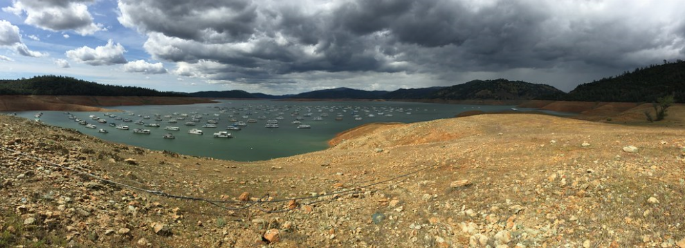
Image Caption: Houseboats in California’s drought-lowered Oroville Lake in April 2015. Source: Image by ray_explores, Flickr.
These reductions in precipitation and water available for irrigation were being balanced by increased groundwater pumping [12]. However, such water reserves are non-renewable, making this approach highly unsustainable in the event of similar crises in future. Hence, as major droughts are expected to become more frequent and severe in response to climate change, the toll taken on California’s fragile water resources will continue to grow, increasing the state’s vulnerability to these extreme weather events with time.
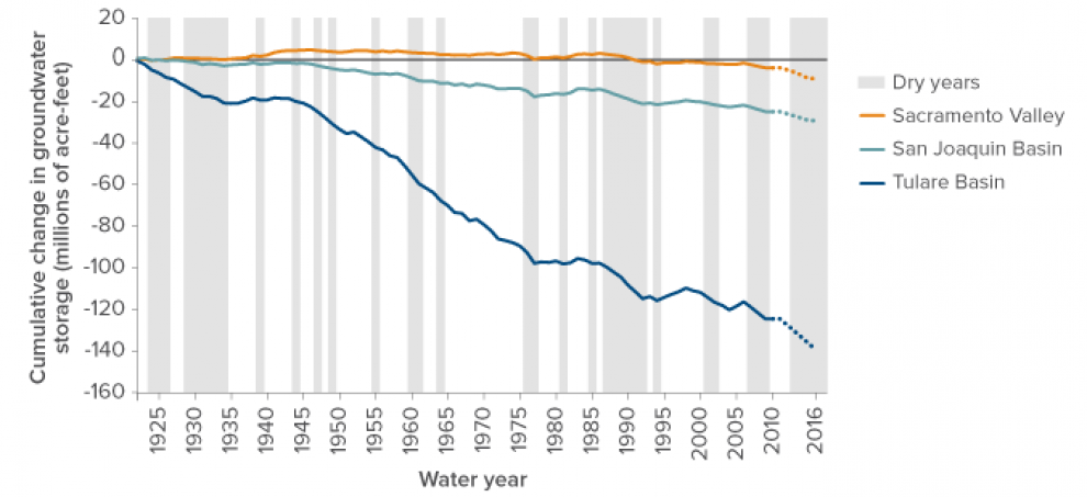
Image caption: California drought Changes in California’s groundwater storage through time. Source: Image by Chappelle et al. (2017).
Future Directions: The Issue of Communication
Arguably the main issue that is central to every aspect contributing to California’s vulnerability to drought is how to effectively communicate these problems to the very same people who are considered vulnerable. In other words, how can we make the people we are trying to protect care enough about what it is they need to be protected from to take action? One of the main issues is that the majority of people have not felt the truly catastrophic effects of a prolonged drought before. Whilst past droughts such as the 2011-2017 event have been severe, people have generally managed to continue their daily lives with little interruption. For example, urban water supplies in California have been successfully managed and maintained during past droughts, but only as a result of considerable intervention involving groundwater extraction [1], [12].
However, the perceptions of rural and agricultural populations are also highly conflicted, amplifying these groups’ vulnerability to drought as well. For example, in March 2014, the NOAA issued a 50% chance of an El Nino proliferating throughout the year. This announcement led many people within the agricultural community to speculate that drought conditions would improve, with the 1997-98 El Nino event that resulted in heavy rains and flooding across California fresh in people’s memories. As a result, these people develop an oversimplified perception about the predictability of climate, having unrealistic expectations of forecasting agencies to accurately anticipate the possibility of changes in climate [13]. Subsequently, this misperception serves to heighten these agricultural populations’ vulnerabilities to drought, as they expect (and hence only prepare) for one outcome: that conditions will improve. This, in turn, has ramifications for the remaining Californian population who depend on these rural communities for their agricultural production, compounding these groups vulnerability to drought as well.
These misperceptions therefore need urgently addressing at the governmental level, who need to emphasise the inherent uncertainty prevalent in all weather and climate forecasting. Furthermore, discussions of mitigation and adaptation options also need to take priority at the governmental level, with such discussions communicated clearly to the general population so as to encourage cooperation with any policies put forward, and to reduce overall vulnerability to droughts.
References
[1] AghaKouchak, A., Feldman, D., Hoerling, M., Huxman, T. & Lund, J., (2015). Water and climate: Recognize anthropogenic drought. Nature News, 524(7566), 409.
[2] Belmecheri, S., Babst, F., Wahl, E. R., Stahle, D. W. & Trouet, V., (2016). Multi-century evaluation of Sierra Nevada snowpack. Nature Climate Change, 6(1), 2.
[3] Seager, R. & Vecchi, G. A., (2010). Greenhouse warming and the 21st century hydroclimate of southwestern North America. Proceedings of the National Academy of Sciences, 107(50), 21277-21282.
[4] Feinstein, L., Phurisamban, R., Ford, A., Tyler, C. & Crawford, A., (2017). Drought and equity in California. Pacific Institute.
[5] Bliss, L., (2015). A Historic Drought Meets a Century of Disparity in California’s Central Valley. Citylab. Available at: https://www.citylab.com/environment/2015/10/before-californias-drought-a-century-of-disparity/407743/.
[6] Wikstrom, K., Miller, T., Campbell, H. E. and Tschudi, M., (2019). Environmental inequities and water policy during a drought: burdened communities, minority residents, and cutback assignments. Review of Policy Research, 36(1), 4-27.
[7] Thompson, A., (2015). Drought takes $2.7 billion toll on California agriculture. Climate Central. Available at: https://www.climatecentral.org/news/drought-cost-california-agriculture-19061.
[8] Cooley, H., Donnelly, K., Phurisamban, R. & Subramanian, M., (2015). Impacts of California’s ongoing drought: agriculture. Pacific Institute: Oakland, CA, USA, 24.
[9] Hanak, E., Mount, J., Chappelle, C., Lund, J., Medellín-Azuara, J., Moyle, P. & Seavy, N., (2015). What if California’s drought continues? Public Policy Institute of California.
[10] Seager, R., Hoerling, M., Schubert, S., Wang, H., Lyon, B., Kumar, A. & Henderson, N., (2015). Causes of the 2011–14 California drought. Journal of Climate, 28(18), 6997-7024.
[11] Nagourney, A., (2015). California imposes first mandatory water restrictions to deal with drought. New York Times.
[12] Chappelle, C., Hanak, E. & Harter, T., (2017). Groundwater in California: just the facts. Public Policy Institute of California. Available at: https://www.ppic.org/publication/groundwater-in-california/.
[13] Werner, K. V., McNutt, C., Anderson, M., Ewald, J., Gleason, K. L., Hameedi, M. J. & Wulff, R., (2015). California drought: 2014 service assessment. Available online
Further Reading
1. AghaKouchak, A., Feldman, D., Hoerling, M., Huxman, T. & Lund, J., (2015). Water and climate: recognize anthropogenic drought. Nature News, 524(7566), 409.
2. Cheng, L., Hoerling, M., AghaKouchak, A., Livneh, B., Quan, X. W. & Eischeid, J. (2016). How has human-induced climate change affected California drought risk?. Journal of Climate, 29(1), 111-120.
3. Christian-Smith, J., Levy, M. C., and Gleick, P. H., (2015). Maladaptation to drought: a case report from California, USA. Sustainability Science, 10(3), 491-501.
4. Moser, S. C., (2010). Communicating climate change: history, challenges, process and future directions. Wiley Interdisciplinary Reviews: Climate Change, 1(1), 31-53.
5. Webster, M., (2003). Communicating climate change uncertainty to policy-makers and the public. Climatic Change, 61(1), 1-8.
The vulnerability of New Orleans: A lesson learnt too late
by Anisha Desai
New Orleans, nicknamed ‘the Big Easy’, is known for its vibrant jazz music scene, Mardis Gras festival and… Hurricanes. Since being settled by the French in the early 18th century hurricanes have been an integral part of the city’s history [1]. Most memorable perhaps was Hurricane Katrina. Although it was only classed as a Category 3 hurricane on the Saffir-Simpson Scale, when it made landfall just off the coast of Louisiana the impact of it revealed a complex picture of vulnerability within New Orleans
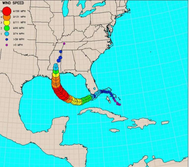
Image caption: Path that Hurricane Katrina took before making landfall in Louisiana as a Category 3 hurricane. Source: The National Oceanic Atmospheric Administration (NOAA).
Geography of New Orleans
For years before Hurricane Katrina experts had warned that New Orleans was extremely vulnerable to the impact from hurricanes due to the physical exposure of the city [2]. In his 2001 Scientific American article, Mark Fischetti stated that “New Orleans is a disaster waiting to happen” [3]. The Federal Emergency Management Agency (FEMA) listed a hurricane strike in New Orleans as one of the calamitous threats to the nation, on par with a large Californian earthquake [4].
Built within a natural basin below sea level [5] the city was already vulnerable to flooding by storm surges, created by intense hurricanes as their strong winds pushed seawater onto land. Over the years, its vulnerability has increased as the surrounding swamplands were drained to encourage city expansion and prevent disease [6]. At present much of the northern city is more than six feet below sea level [7]. What’s more, storm surges originate just to the south of the city where the Mississippi River flows into the Gulf of Mexico. Hurricanes tracking northwest from Africa are fuelled by the warm moisture from the Gulf of Mexico and reach maximum intensity enabling these storm surges to form that are responsible for most hurricane-related fatalities. Due to the bowl-shaped structure of New Orleans, when Katrina hit and formed 19 feet high storm surges the city was flooded, and once water entered it could not escape. Instead it lay stagnant for weeks, soaking tens of thousands of homes in a festering soup of waste, chemicals, micro-organisms, and eventually mould [2].
Human interference has also destroyed wetlands and barrier islands that used to act as natural defences against storm surges, further increasing vulnerability of the city [2]. Dams built upriver of the city reduced the amount of sediment in the river by up to 67%, and levees along the Mississippi River reduce the amount of sediment flowing into the wetlands. This means that the river is not naturally replenishing the wetlands, and so over the past 50 years they have been disappearing at a rate of 60 km per year. This effect has been further exacerbated by the construction of canals in and around New Orleans that have increased the influx of saltwater into the freshwater marshes and wetlands, that kills native plants [7].
Levees
Levees are walls that prevent waterways from overflowing and flooding nearby areas. Over thousands of years the Mississippi River has periodically overflown, depositing sand and silt onto the active floodplain, forming a ridge or “natural levee” [6]. When the French settled, these ongoing floods convinced the settlers to construct private levee systems to protect their properties. By 1735 this system had grown and expanded to 35 miles. Authorised for construction in 1965 after Hurricane Betsy flooded much of the city, the modern system now stretches 350 miles along the Mississippi River and around Lake Pontchartrain [7].
The Army Corps of Engineers proposed two plans designed to protect the city from a fast-moving Category 3 storm, termed “Standard Project Hurricane”. The first “Barrier Plan” involved barriers and gates, however it was rejected in the 1970s due to environmental impact issues raised by the ‘Save Our Wetland’ organisation. The second “High Level Plan”, implemented in the 1980s, involved raising the height of the levees by building floodwalls on top of them, or constructing walls in place of a levee when space was insufficient for its broad base. Most commonly used was the I-wall as this was the cheaper option even though T- walls offered more resistance. However, failure of these I-walls was the reason for the severe flooding that occurred during Hurricane Katrina, with 53 walls in total being breached under the impact of the storm. Corps concluded in 2006 that the levee system had been vulnerable to failure due to insufficient funding, information and poor construction, and at the time tests of the system had been mis-interpreted [5].
Not only did the levee system fail, but its mere presence caused the populace of New Orleans to have a false sense of security and complacency that contributed to the lack of evacuation plans during Hurricane Katrina. Those living near the breaches were most prone to loss of property, and if not evacuated, loss of life. Inevitably the poor and the infirm communities were the most vulnerable.
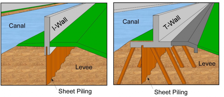
Image caption: I-walls (left) are cheaper but less stable than T-walls (right) as they rely on gravity to keep them down, whereas T-walls are reinforced on either side and so are less likely to be breached [5].
The Future
New Orleans is subject to high exposure to future hurricane events due to its geographical location. Hurricane Katrina demonstrated the high vulnerability of the city due to its poor defences system, lack of evacuation plans, destruction of natural defences, lack of public awareness and general complacency of the populace. The event also highlighted the cost to property, and more importantly, to human life caused by cutting corners in the construction of floodwalls. Sadly, it also showed that even in the richest country in the world social inequalities can have catastrophic effects.
The US Army Corps of Engineers still have not realised their mistake, and rather than spending money on improving the cities defences, they spent $14.6 billion rebuilding the same levee system that failed during Katrina [8]. This again raises complacency within the region, thereby further increasing the vulnerability of New Orleans to future events. There have been plans to increase the size of the wetlands by 100 km2 by 2031, however this is proving to be a slow and difficult plan to enact. Some studies have suggested that the best course of action would be to allow the marshes at the river mouth to vanish altogether in order to allow those nearer the city to flourish again [6].
There is concern that the current rate of climate change will cause hurricanes the size of Katrina to be ever more likely in the future [8]. Not only do warmer temperatures increase the capability of hurricanes to carry moisture that fuels its path of destruction over land, but it also causes hurricanes to move slowly, thereby prolonging the impact in unprepared areas. A future event on par with Hurricane Katrina is likely around the corner, and yet New Orleans remains vulnerable and unprepared for such events, despite its devastating history.

Image caption: Left: Already below sea level, here can be seen water spilling into New Orleans on August 30, 2005. Source: United States Navy. Right: Hurricane Katrina left over 1,800 dead, destroyed $100 billion worth of property and compromised 800,000 houses, leaving thousands homeless. Source: United States Air Force.
References
[1] Fitzpatrick, P. J., 1991. Hurricanes: A Reference Handbook.
[2] Yarnel, B., 2007. Vulnerability and all that Jazz: Addressing Vulnerability in New Orleans after Hurricane Katrina, Technology in Science, 29, 249-255.
[3] Fischetti, M., 2001. Drowning New Orleans, Scientific American.
[4] Townsend, F. F., 2006. The Federal Response to Hurricane Katrina Lessons Learned.
[5] Nelson, S. A., 2012. Why New Orleans is Vulnerable to Hurricanes Geologic and Historical Factors, Tulane University.
[6] Tibbetts, J., 2006. Louisiana’s Wetlands: A Lesson in Natural Appreciation, Environmental Health Perspectives, 114(1), A40-A34.
[7] Below, C., Dierich, C., Erickson, K., & Kjos, R. Environmental Hazards Storm Surge Induced Flooding in New Orleans.
[8] Gibbens, S. 2019. Hurricane Katrina explained, National Geographic.
Further Reading
1. Fischetti, M., 2008. Drowning New Orleans, Scientific American.
2. Rogers, J. D., Kemp, G. P., Bosworth, H. J., & Seed, R. B., 2015. Interaction between the US Army Corps of Engineers and the Orleans Levee Board preceding the drainage canal wall failures and catastrophic flooding in New Orleans in 2005, Water Policy, 17, 707-723.
3. Schwartz, J., & Schleifstein, M., 2018. Fortified but still in peril, New Orleans braces for its future, New York Times.
4. Laska, S. B., & Morrow, B. H., 2006. Social Vulnerabilities and Hurricane Katrina: An Unnatural Disaster in New Orleans, Marine Technology Society Journal, 40(4), 16-26.
5. Zoraster, R. M., 2010. Vulnerable Populations: Hurricane Katrina as a Case Study, Prehospital and Disaster Medicine, 25(1), 74-78.
Resources:
MSc Geophysical Hazards:
General enquiries: Dr Emma Nicholson
How To apply
PG Cert Natural Hazards for Insurers:
General enquiries: Dr Alexander Steele
How To apply
 Close
Close

