Accurate 3D maps of forests are helping scientists assess carbon stores
A new laser scanning method that sizes up live trees in three dimensions is providing accurate measures of the world’s carbon stores and highlighting the value of trees in tackling climate change.

8 October 2020
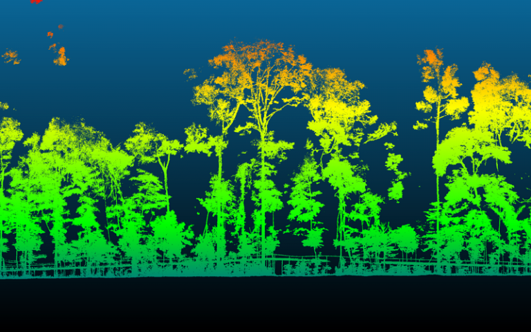
A section through an area of the Brazilian rainforest, visualized using laser measurements collected by Professor Mathias Disney.
Trees are one of the planet’s key stores for carbon, so conservation of forests and additional tree planting are important parts of global strategies to mitigate greenhouse gas emissions.
To estimate the size of forests and the amount of carbon they can store, scientists use ground-based measures and data collected by satellites in space.
“Until now, accurate measurements have been hampered by the difficulties of assessing the mass of live trees,” explains Professor Mathias Disney (UCL Geography).
““This technology will also help us understand better how plants absorb and release carbon naturally, in response to changing climate and under an increasing range of human activities.”
Professor Disney has adapted a technology called terrestrial laser scanning (TLS) to measure forests’ structure and the amount of material within them that is capable of storing carbon.
To provide a detailed 3D ‘picture’ of the forest, laser pulses are directed up to a million times a second at different parts of the forest. The laser records the precise 3D location of every “hit”. Analysing these detailed 3D maps provides accurate information on the shape and volume of every tree, branch and leaf that the laser “sees”.
This information, combined with data from space missions from NASA and the European Space Agency (ESA), as well as other national and international space agencies, provides more detailed and accurate information on the world’s carbon stocks.
Professor Disney is working with ecologists, forestry and climate researchers and non-governmental organisations around the world to quantify the extent and benefits of forests – from large tropical forests to small urban forests – to help planners and policy-makers make better land management decisions to conserve and extend forests.
“This technology will also help us understand better how plants absorb and release carbon naturally, in response to changing climate and under an increasing range of human activities, such as fire and deforestation,” Professor Disney explains.
 Close
Close


